Several inches of rain have already fallen in many communities of west-central Florida this week, and with more anticipated over the next two days, the risk of flooding will continue.
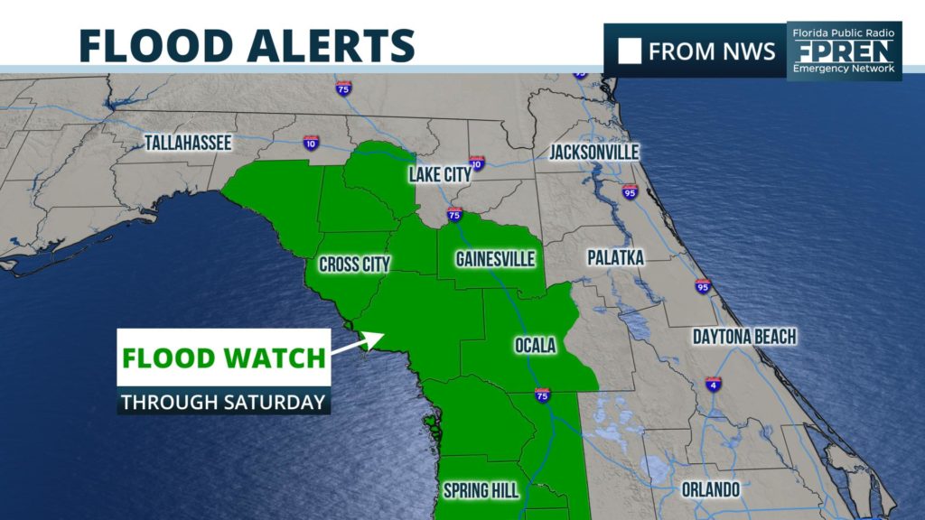
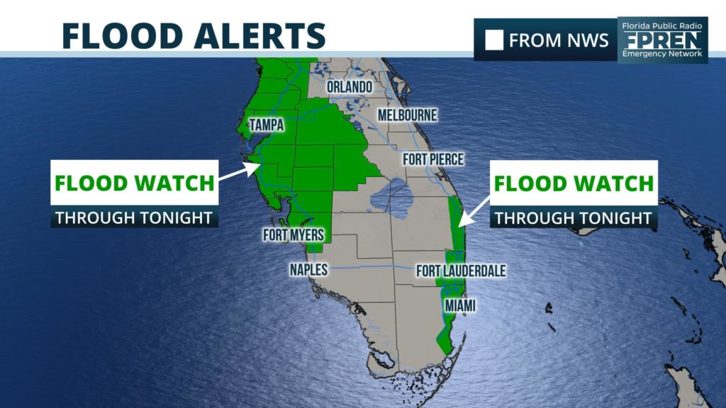
A Flood Watch has been issued for parts of Florida’s Big Bend and inland areas of North Florida through Saturday evening. Flood Watches also continue for much of west-central Florida and southeast Florida through Friday evening.
3 to 7 inches of rain has fallen near the Nature Coast and north of Tampa since Monday, according to estimates from doppler radar and several reporting stations.
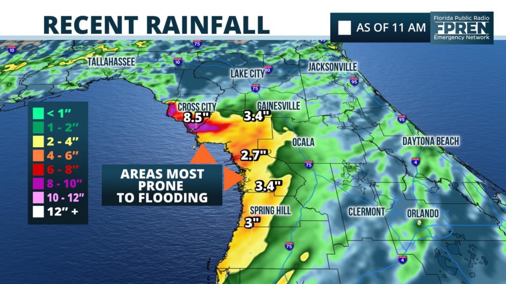
Occasional rounds of heavy rain are likely to persist through Saturday in these areas, where NOAA’s Weather Prediction Center forecasts another 3 to 6 inches may fall.
There are signs that the heavy rain will not be as widespread over the weekend from the Tampa/St Pete metro area southward to the Fort Myers area. In these areas, the Flood Watch is set to expire Friday evening.
Anomalously persistent southwest winds from the Gulf of Mexico and a stalled front has encouraged the development of heavy showers and thunderstorms over the past few days. A ridge of high pressure over the Atlantic Ocean is forecast to gradually build into central and south Florida Sunday and Monday. As it does, the front will shift northward into Georgia and the winds in the lower part of the atmosphere will gradually become southerly and southeasterly. These two factors should allow for a transition to a more typical pattern of thunderstorms by Monday across the state.
Even though the overall weather pattern is expected to slowly improve this weekend in west-central Florida, there will still be scattered thunderstorms in the Tampa/St Pete, Sarasota, and Fort Myers areas that may trigger brief instances of flooding in vulnerable areas. The same can be said for areas further north by Sunday and Monday.


