Cue the lights, strike up the band - a cast of three tropical storms could make for some interesting Atlantic theater over the next two weeks.
But here’s a thought we won’t “dance around”: It is far too soon to speculate whether any of them will be a U.S. threat.

Tropical storms Jerry, Karen and Lorenzo have all taken the stage, but they may not be in rhythm. Jerry will likely take the lead with Karen, but both may be no match for Lorenzo’s moves. The question then is whether Karen will be just a supporting role, or possibly become a headliner with significant implications for Florida.
Dancing analogy aside, the situation in the Atlantic is complex and requires a bit of training (or explaining on our part).
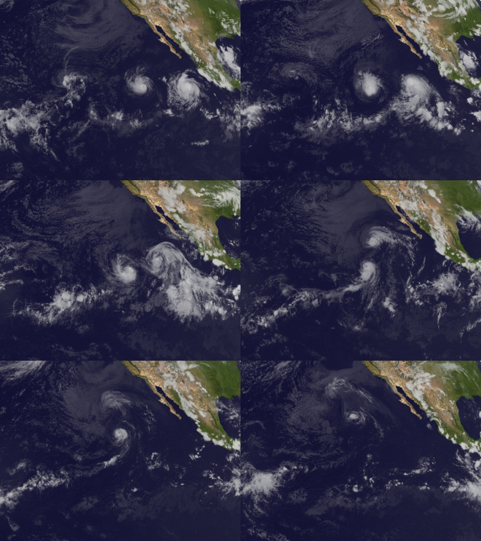
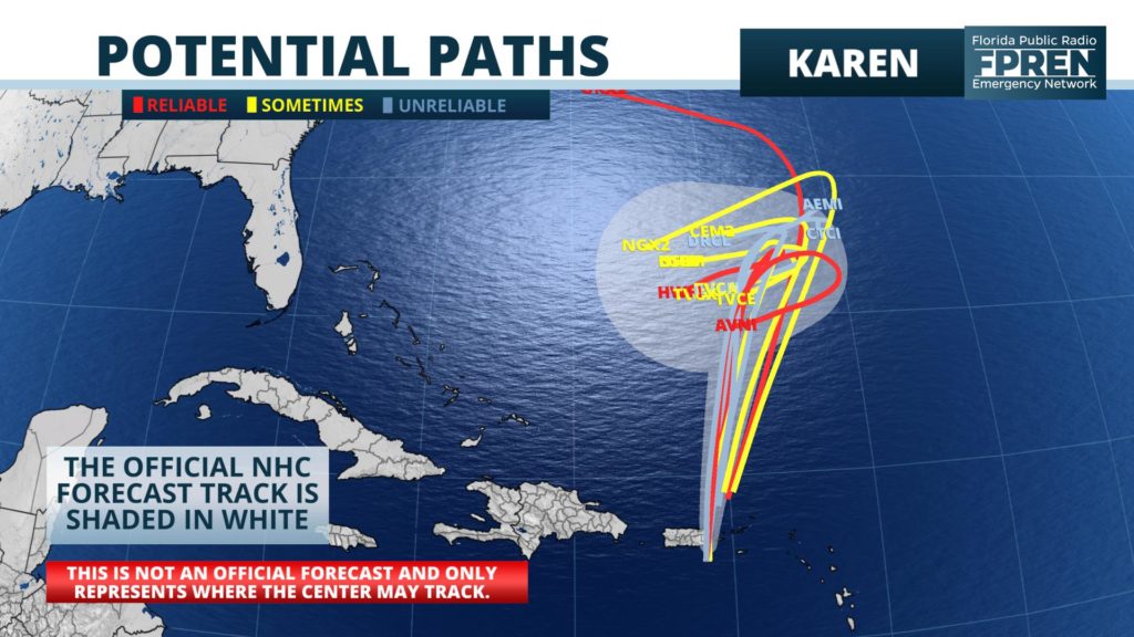
Tropical Storm Karen is expected to move north out of the Caribbean into the southwestern Atlantic, almost following in Tropical Storm Jerry’s footsteps. However, Jerry is expected to move more slowly than Karen, which means the two circulations may come close enough to interact and spin around one another — a process known as “Fujiwhara”. Fujiwhara becomes more likely when two tropical cyclones come within about 500 miles of one another. Not all models are showing this unusual occurrence, but the possibility exists.
More on the Fujiwhara Effect

When two hurricanes spinning in the same direction pass close enough to each other, they begin an intense dance around their common center. If one hurricane is a lot stronger than the other, the smaller one will orbit it and eventually come crashing into its vortex to be absorbed. Two storms closer in strength can gravitate towards each other until they reach a common point and merge, or merely spin each other around for a while before shooting off on their own paths. But often, the effect is additive when hurricanes come together — we usually end up with one massive storm instead of two smaller ones.

Even if Fujiwhara does not take place, the track forecast for Karen still has complexities. The position and strength of a building ridge over the eastern United States and western Atlantic will have a large say on the future track of Karen. Also, the strength and vertical depth of Karen itself will determine how and where it is likely to be steered. The various models that typically do the best in forecasting storm strength have also been in strong disagreement.
There is one more, potentially complicating factor: Hurricane Lorenzo is rapidly strengthening and is expected to become a large, powerful hurricane over the central tropical Atlantic Ocean this weekend. If Lorenzo gets close enough to Jerry or Karen, there is the potential of interaction between it, and one or the other. In this situation, the circulation of influence from Lorenzo might be so large that Karen and/or Jerry could dissipate entirely.
Even though few people like uncertainty, these potentially complex, hard-to-predict interactions — if they happen at all — are most likely to occur in the open waters of the Atlantic Ocean over a span of nearly a week.
It may be more than five days from now before we can confidently project whether Jerry, Karen, or Lorenzo will ever have an effect on the United States mainland.
The official advisories from the National Hurricane Center for each tropical storm or hurricane are provided below.
