Forecast data became much clearer Wednesday on what may, or in this case may not, happen with Tropical Storm Karen in the coming days.
Tropical Storm Karen has refused to intensify since leaving Puerto Rico, and newest data suggests the storm may dissipate entirely before ever becoming a threat to Florida.
The National Hurricane Center is now forecasting Karen to stay a minimal tropical storm over the next five days. Hurricane Specialist Robbie Berg even noted in his 5 pm advisory that the official forecast “could be lowered further” in subsequent updates.
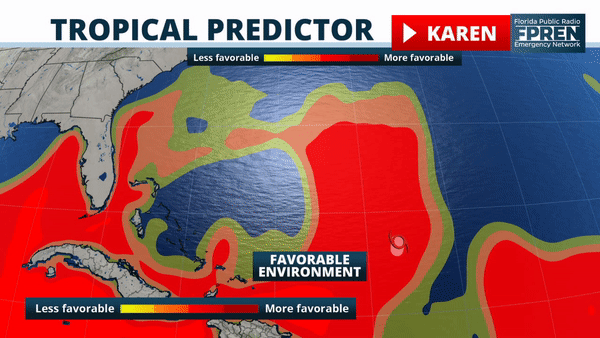
The reason for the downward trend is an environment that is likely to become increasingly unfavorable along its future path. Up until Wednesday afternoon, forecaster Berg noted there was a dichotomy of ideas on how Tropical Storm Karen would behave. However, recent struggles to become better organized have led his team to move in a weaker direction with Karen.
The track forecast for Tropical Storm Karen has generally remain unchanged. The season’s eleventh named storm is expected to continue on a north-northeast path through Friday, before slowing down and looping back to the west over the weekend. The forecast position at day five (Sunday) is roughly 800 miles to the east of Florida. If Karen is still a tropical storm or depression at that time, which is unlikely based on current data, it would be moving west or west-southwest and potentially nearing the state of Florida by the middle of next week.
It should be noted that what may happen to Karen or its remnant tropical wave beyond Sunday, especially as it relates to any implications to Florida, is not within the scope of any credible forecast information at this time.
Jerry was moving steading toward Bermuda, but had lost its tropical characteristics and become "post-tropical". The National Hurricane Center said gusty winds and large ocean swells were still possible on the island through Thursday.
Latest advisory on Jerry
Hurricane Lorenzo is expected to become a powerful hurricane over the eastern Atlantic Ocean by this weekend, but is not a threat to any land areas.
Latest advisory on Lorenzo
There are no other tropical developments expected in the Atlantic Ocean, Caribbean Sea or Gulf of Mexico over the next five days.


