The season’s first freeze is likely tonight in the Florida Panhandle, and subfreezing wind chills are possible across portions of North Florida Wednesday morning.
A strong cold front was noted to be moving through the northwestern corner of the state early Tuesday morning, where temperatures tumbled more than twenty degrees over just two hours in Pensacola.
As of midday, the front had cleared Tallahassee and had its sights set on Jacksonville and Gainesville, where temperatures were expected to fall quickly after sunset.
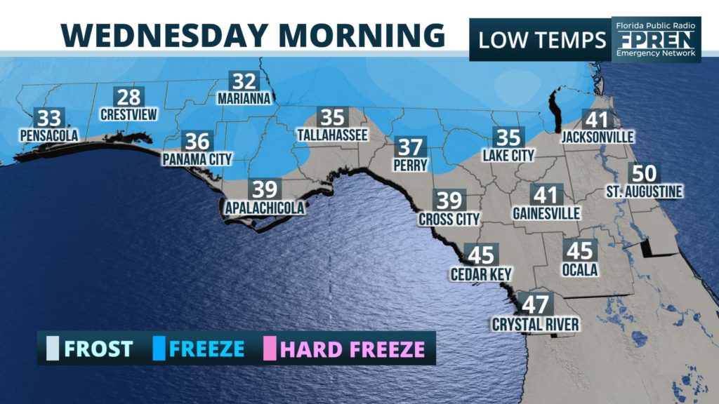
A Freeze Warning has been issued for most of the Florida Panhandle west of Tallahassee from 10 pm to 8 am overnight. The National Weather Service is projecting overnight lows as cold as 27 or 28 across inland areas north of Pensacola, with subfreezing temperatures also likely from the Emerald Coast to Marianna, Florida.
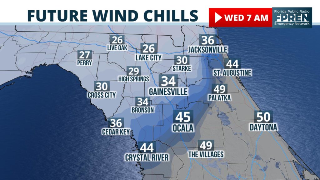
Sharply colder air is also expected tonight across north and northeast Florida, where the combination of falling temperatures and gusty winds will yield wind chills - what it will feel like to exposed skin - in the upper 20s and lower 30s by daybreak Wednesday morning.
Actual temperatures in these areas will fall to the upper 30s and lower 40s around sunrise, ranging from 35 in Lake City to 41 in Gainesville and Jacksonville.
Central and South Florida will experience a notable change in temperature as well from the massive front, although not as dramatic. Wednesday afternoon temperatures along the I-4 corridor from Tampa to Orlando will only be able to recover to the lower 60’s, after spending several hours in the 50s after sunrise. Farther south, afternoon highs will range from the upper 60s near Fort Myers to the lower and middle 70s along the Atlantic Coast from Miami to Melbourne.


