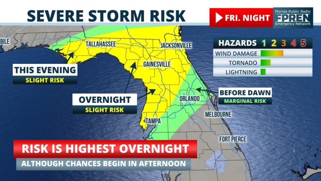
The risk of wind damage and possibly a tornado is increasing across portions of Florida Friday night. Multiple rounds of showers and thunderstorms are possible across the northern half of the state during the day, but the strongest activity is now expected to arrive after sunset.
A complex upper-level storm system is forecast to swing through the Southeast Friday, and clusters of strong thunderstorms are expected to develop ahead of it across several different areas of Florida in the afternoon, evening and overnight hours. Forecasters at the Storm Prediction Center, which is a division of the National Weather Service, have placed much of northern Florida under a “slight” (level 2 out of 5) risk for severe weather through 7 am Saturday. This was a categorical upgrade to the forecast issued for the same period of time Thursday.

The primary hazards with the strongest cells will be damaging wind gusts or a brief tornado. The highest chances of this occurring are across the eastern half of the panhandle this evening, then stretching into the northern half of the peninsula overnight. However, a few strong thunderstorms may also develop across portions of North Florida in the afternoon hours Friday.
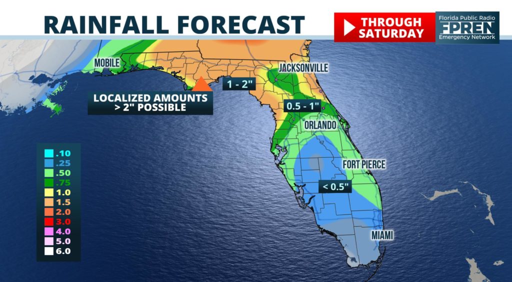
Locally heavy rain will also be possible at times in the same areas affected by the stronger thunderstorm potential. Rainfall amounts through Saturday are likely to exceed an inch across a large area of the state north of I-4, with locally higher amounts of up to two inches possible closer to the Gulf Coast. Lesser amounts of rain are expected, primarily on Saturday morning, for areas of central and south Florida.

The storm system responsible for the unsettled late-week weather is expected to clear the state Saturday afternoon, leaving behind a drier and more stable air mass for the second half of the weekend. The more favorable weather for outdoor activities should continue into the early part of next week.
