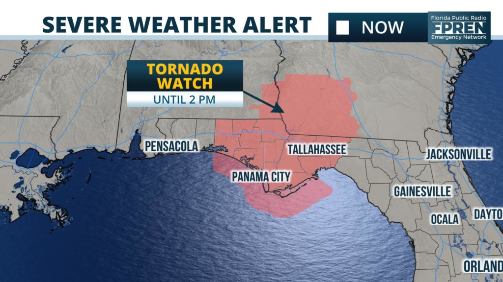
The National Weather Service has issued a Tornado Watch until 2 PM for much of the Florida Big Bend and portions of the Panhandle. The Tornado Watch includes Tallahassee, Panama City, Marianna, and Apalachicola.

The larger storm system produced more than 3 dozen tornado reports over Alabama, Mississippi, and Louisiana on Monday. Its associated cold front is moving into an environment that is not quite as favorable for tornadoes today, but there is enough wind shear and unstable air for a few tornadoes in and near the tornado watch area this morning into early afternoon. Damaging wind gusts may accompany the thunderstorms, as well.
Storms were approaching the Panama City and Marianna areas as of mid-morning, and will reach the Apalachicola and Tallahassee areas around midday. At least one tornado warning has been issued in the Florida Panhandle northwest of Marianna, where radar data strongly suggested there was a touchdown in Jackson County.
The storms are expected to leave the Big Bend area during the mid and late afternoon. Much colder weather is forecast behind the front tonight and Wednesday, and a light freeze is possible early Thursday morning.

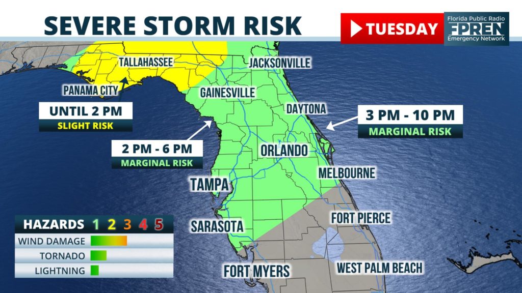
Forecasters at the National Weather Service Storm Prediction Center have also placed much of north and central Florida under a "marginal" (level 1 of 5) risk for severe weather later Tuesday afternoon and evening. Current forecast data suggests minor wind damage or a brief tornado may occur in these areas with the strongest cells.
