The storm responsible for more than three dozen tornado reports across Louisiana, Mississippi, and Alabama on Monday is now moving through the Sunshine State. It is not as robust as it once was, but it still could produce thunderstorms capable of damaging gusts and perhaps a tornado.
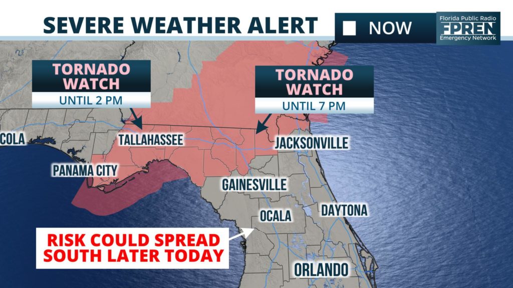
A Tornado Watch is in effect until 2 PM for portions of the Big Bend and Panhandle, including Tallahassee and Panama City. A new Tornado Watch has also been issued for areas farther east along I-10 toward Jacksonville until 7 pm.
Isolated tornadoes and damaging gusts from thunderstorms are possible in and near the watch area. The National Weather Service in Tallahassee said radar data confirmed a tornado in Jackson county, near Graceville, shortly after 7 o’clock this morning. It is not immediately clear at the time of this story how extensive the damage was from the tornado.
Thunderstorms were moving into the Tallahassee area midday, with a threat for damaging gusts and isolated tornadoes. The cold front attached to this storm is expected to sweep eastward Tuesday afternoon and evening. Scattered showers and thunderstorms could develop earlier in the afternoon, well ahead of the front, but the more widespread activity is expected to accompany the front. Here are the estimated times of arrival for the main line of thunderstorms:
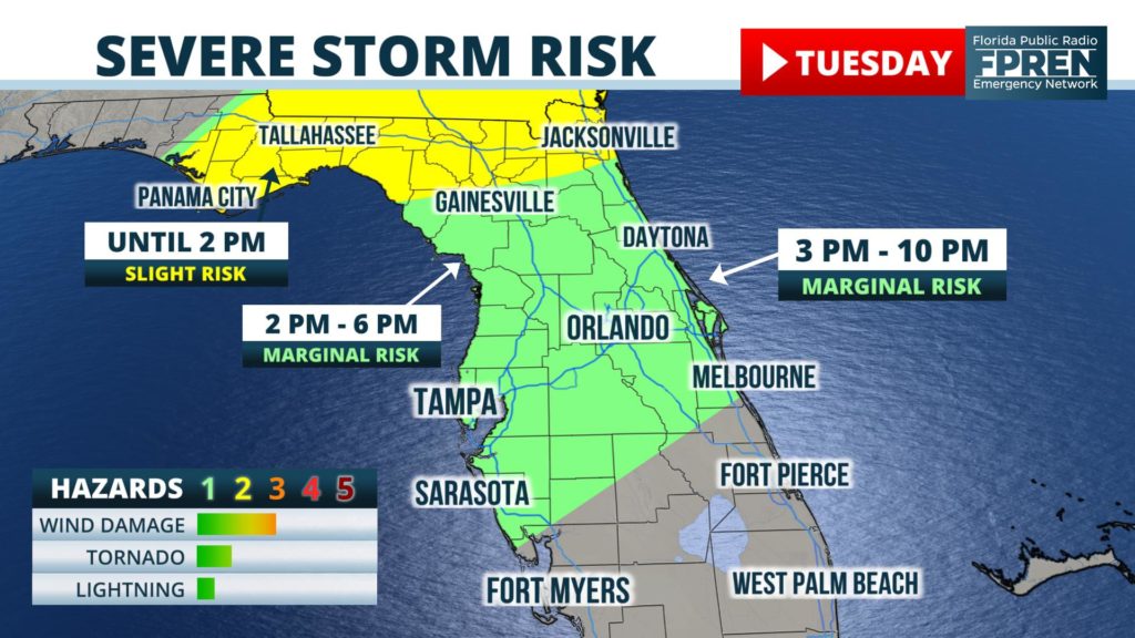
As the front moves across the southern half of the peninsula, upper-level winds are forecast to weaken somewhat, reducing the number of wind damage reports. Residents should still be aware that gusty winds are possible with the strongest thunderstorms as they move through. The high moisture in place will also result in downpours with the showers and thunderstorms.
Scattered thunderstorms are possible before the times listed above. The main line of thunderstorms is forecast to weaken considerably as it reaches Naples, West Palm Beach, and Miami, but scattered thunderstorms are possible in those areas between 3 AM and 10 AM on Wednesday.
Much colder air is expected to flow in behind the front on Wednesday and Thursday. There is a chance of a light freeze in North Florida and the Florida Panhandle, especially closer to the Interstate 10 corridor early on Thursday morning.


