A soaking rain is likely across the Sunshine State Sunday, and it could be heavy enough to cause river or street flooding in some areas.
Thunderstorms capable of producing minor wind damage or a brief tornado are also possible in portions of South Florida Sunday afternoon, although considerable uncertainty remains on whether this risk will materialize.
An area of low pressure is forecast to form in the central Gulf of Mexico Saturday, then gradually strengthen as it moves across the state Sunday. The first area to receive widespread rain is likely to be the Florida Panhandle Saturday night. This will then spread east along I-10 toward Jacksonville and portions of North Florida Sunday morning.
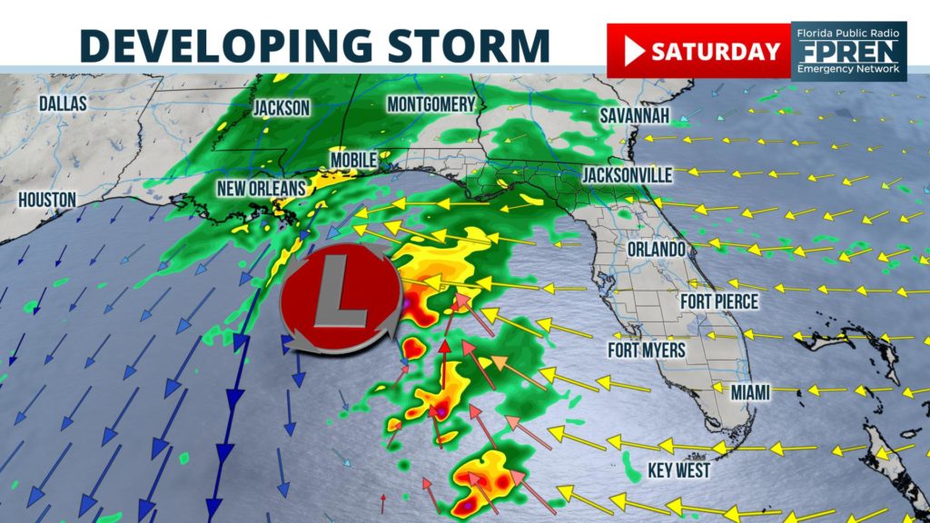
Clusters of heavy rain with embedded thunderstorms are also expected to develop farther south by Sunday afternoon, moving ashore from the Gulf of Mexico near and south of the I-4 corridor. The rain will end in most areas by Monday morning, although scattered showers may persist a bit longer in northeast Florida.
When the heaviest may fall
The following windows of time are when the heaviest and most persistent rain is expected.
The greatest threat from the storm system is excessive rain. Computer model projections as of Friday afternoon are showing widespread 1 to 3 inch rainfall amounts over the state, with a few locations perhaps receiving upwards of 4 inches.
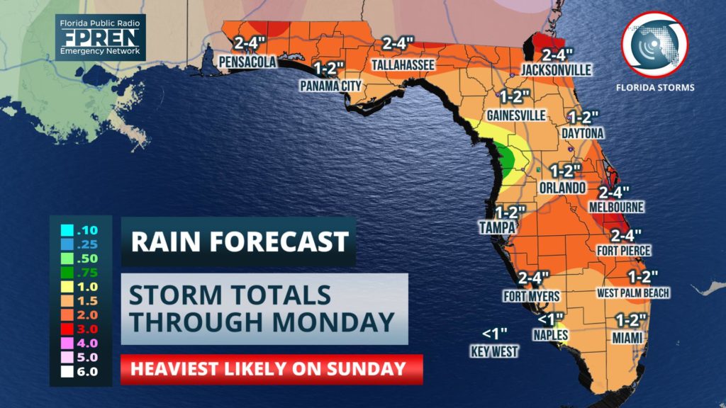
There are some indications from the American and European global models that two pockets of heavy rain — one near I-10 in the Panhandle and another over central Florida — may develop. However, forecasting the precise location of flooding downpours more than a few hours in advance is typically not possible.
Gusty winds from the storm have prompted the National Weather Service to issue Small Craft Advisories or Gale Watches for both the Atlantic and Gulf waters. If the track of the low pressure is over the Panhandle, there may be minor coastal flooding for portions of Florida’s Big Bend as well. Rough surf and rip currents may also create a hazard for those looking to enter the water over the holiday weekend.
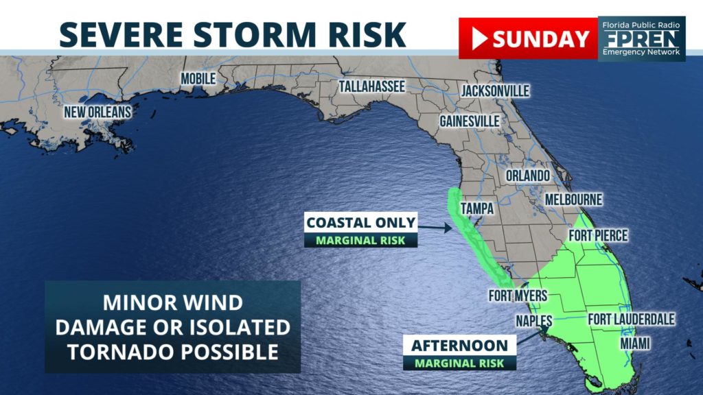
The air mass is expected to become warm, humid, and unstable enough to produce strong thunderstorms, primarily south of Interstate 4, Sunday into Sunday evening. The Storm Prediction Center has issued a “marginal risk”, a level 1 out of a possible 5, for the possibility that a few of the storms may be strong enough to produce damaging gusts and a tornado or two. A widespread outbreak of damaging winds and tornadoes is not presently anticipated, but residents are advised to occasionally monitor the forecast over the weekend for changes.
Scattered showers and a few downpours are possible into Monday, with a clearing trend and return to more typical Florida-like December weather for Christmas Eve and Christmas Day.


