A Tornado Watch has been issued by the National Weather Service for Pensacola and surrounding areas until 4 pm.
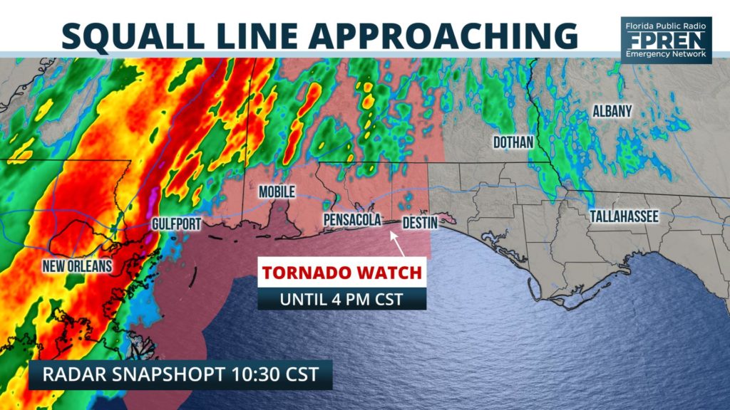
Thunderstorms capable of producing damaging wind gusts up to 60 mph and a brief tornado are possible in the advised area, especially between the hours of 1 and 4 pm CST.
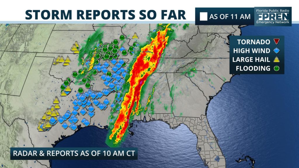
The powerful storm system that has prompted the Tornado Watch has already led to more than 200 reports of wind damage, and at least five tornadoes across the Southern Plains, Ozarks and Mid-South.
Latest forecast data continues to suggest the line of storms responsible for the damage might threaten portions of the Florida Panhandle Saturday afternoon and evening.
A few isolated thunderstorms could develop ahead of the main activity as early as 1 or 2 pm CST. These cells would pose the greatest risk of a brief tornado. The damaging wind risk is greatest when the squall line approaches, which is outlined with updated arrival times below.
The front is then expected to weaken overnight and the severe weather risk will diminish, leaving the rest of Florida largely unaffected on Sunday.


