More than a dozen warm weather records have been tied or broken in Florida over the past three days, and the unusual warmth is expected to continue through at least the end of the week.

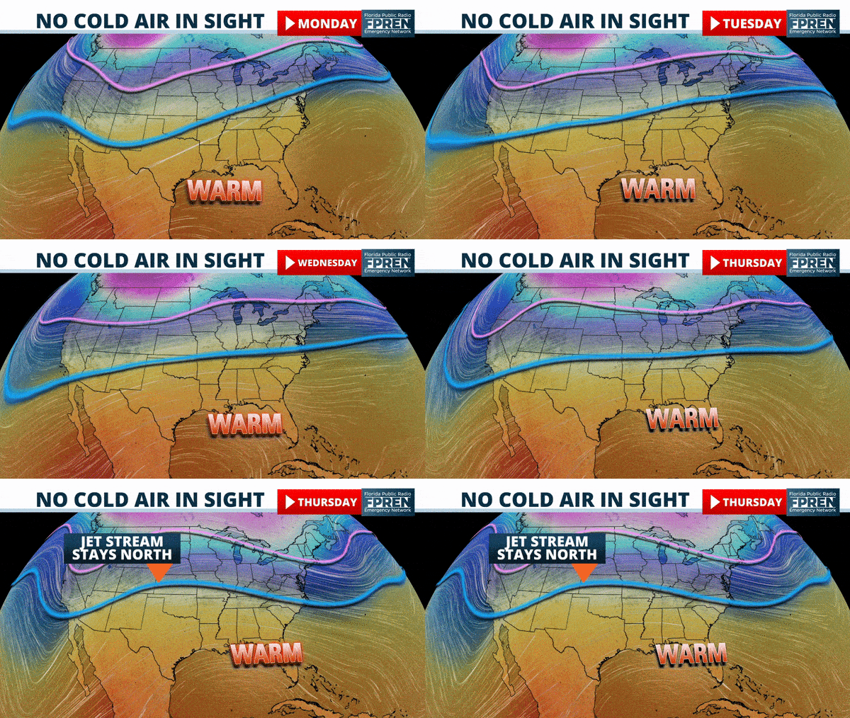
A weather pattern more typical for late summer is in place across the Southeast U.S., and forecast data shows no sign that it will break down anytime soon. Surface and upper-air observations indicate that a large and sprawling area of higher pressure stretches from the Gulf of Mexico to the Bahamas. Jet stream winds will therefore not able to steer storm systems and cold fronts into Florida like they normally would during the winter months.

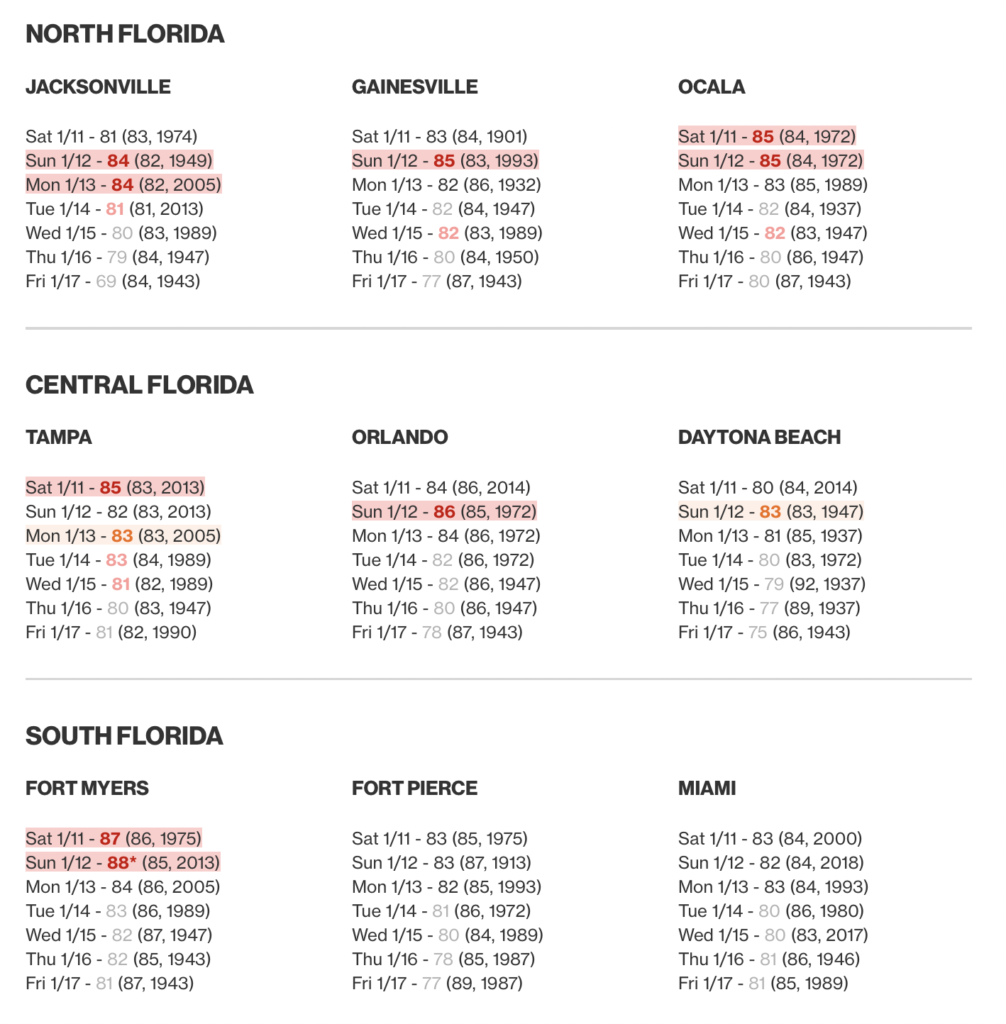
An all-time January high temperature of 89 degrees was set in Naples Sunday, which was the second day in a row a new daily high temperature record was broken. Record highs were common from Jacksonville to Fort Myers Saturday and Sunday, and several more may fall this week.
The lists below represent official climate reporting stations, their actual or forecast high temperatures, compared to the record for the date in parenthesis.
Long range forecast data shows no sign that the overall weather pattern will change much through Friday. The warmth may not be as intense across the peninsula near the end of the week due to a stronger easterly wind and more influence from the Atlantic Ocean. The next cold front that is likely to have a significant influence on temperatures in Florida may not arrive until Monday or Tuesday of next week.
