More than four million Floridians are likely to experience a freeze over the next two nights, including rural areas of Southwest Florida by Wednesday morning.
The cold spell follows a week of abnormal warmth in the Sunshine State, when more than a dozen record highs were tied or broken.
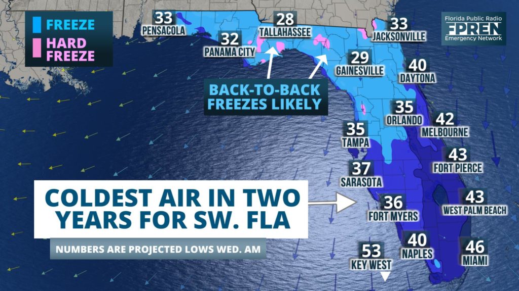
This will likely be the coldest two days in Florida since January 2018, when freezing temperatures made it as far south as Fort Myers and Lake Okeechobee. That month was also the last time the mercury dipped below 40 in cities such as Tampa, Naples, Sarasota and Bradenton. The last time 30s were observed in Miami was December 24, 2012. The latter is less likely, but still possible Tuesday night.
Two weather features are teaming up to produce the prolonged three-day stretch of cold weather. First, a cold front moved through late Sunday. Temperatures were already noted to be dramatically falling across the northern half of the state early Monday.
Second, a storm area of low pressure is expected to develop just east of Florida Tuesday. Increasing north winds on the backside of the departing storm are expected to pull even colder air into the state by sunset. Timing is a bit in question on when those winds may die down, and the coldest numbers Wednesday morning will be realized where the breeze diminishes the most by daybreak.
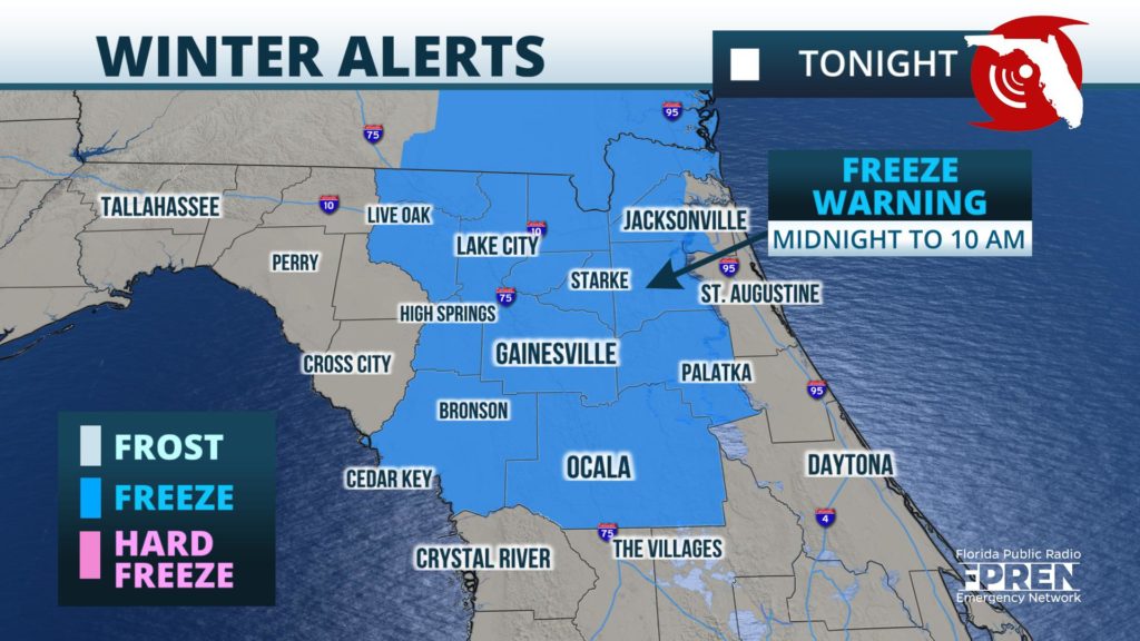
This blast of cold air is strong enough to prompt the National Weather Service to issue a Freeze Warning for portions of north and northeast Florida.
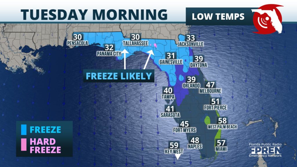
Temperatures Tuesday morning are likely to range from the upper 20s in rural areas along the I-10 corridor, to the lower 30s in north Florida and the upper 30s across Central Florida.
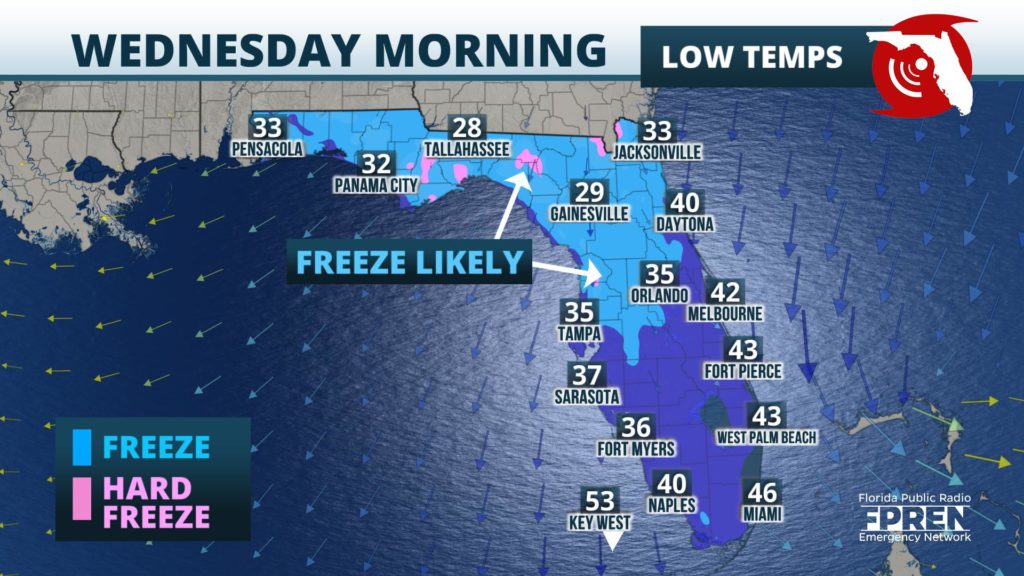
Temperatures Wednesday morning are likely to be at least 3 to 5 degrees colder across portions of central and southwest Florida. Lows near freezing are possible in rural areas as far south as Sebring and Arcadia (just east of Sarasota and Bradenton). .
Daytime temperatures Tuesday will be running 10 to 15 degrees below normal as well, with highs likely only to reach the 40s in the panhandle, 50s along and north of I-4, and 60s across South Florida. The air mass will begin to modify Wednesday, when temperatures are expected to warm to near-normal values. Even warmer weather is possible Thursday and Friday ahead of the next front, which is anticipated to arrive Friday.


