A two-day outbreak of severe thunderstorms is possible across the Florida Panhandle and much of north and central Florida this week. This is an earlier-than-normal notice on the potential for a significant episode of strong storms.
Wind damage and tornadoes will be the primary hazards, although heavy rainfall and flash flooding will also be possible from a strong cold front that will move across the Southeast Wednesday and Thursday.
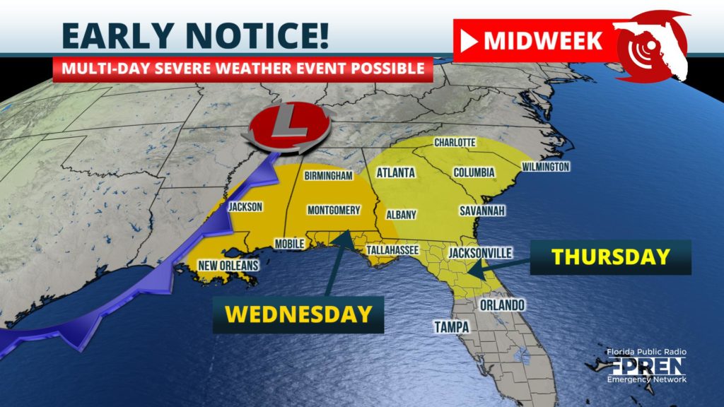
An area of low pressure was observed moving across Intermountain West Sunday, while at the same time a potent area of energy was approaching the Pacific Northwest. Forecasters at the National Weather Service expect these two features to morph into a powerful storm system over the Central Plains by Tuesday. A strong cold front associated with the storm is then expected to approach the Florida Panhandle Wednesday, and move farther east toward the Florida Peninsula Thursday and early Friday.
Forecasters at the National Weather Service's Storm Prediction Center began advising on the potential multi-day severe weather event on Friday.
Ample moisture moving in from the Gulf of Mexico, combined with strong upper-level winds approaching from the west, will create an atmospheric environment favorable for multiple days of unsettled weather. Damaging straight-line winds and tornadoes will both be possible in the stronger storms. In addition, excessive rainfall rates could produce areas of flash flooding, thanks to a deep connection to the subtropics yielding higher-than-normal levels of moisture.
Details on the timing and severity of the risk will likely change in the days ahead, and meteorologist from Florida Public Radio Emergency Network will provide frequent updates on this site, in the Florida Storms mobile app, and on social media.


