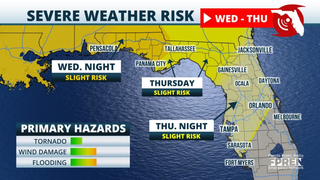
Multiple weather-related hazards are possible over a large portion of the Sunshine State Wednesday night through Friday morning.
A strong storm system is expected to develop across the Southern Plains Tuesday, then spread into the Mid-South Wednesday, before slowing down as it sweeps across Florida Thursday and Friday.
An increasingly warm and humid air mass will surge northward across the Florida Panhandle first on Wednesday evening. Showers and thunderstorms are likely to form along a warm front between 3 pm and midnight near Pensacola, Fort Walton, Panama City, and Marianna. It is possible a few of these storms will produce damaging wind gusts and an isolated tornado or two.
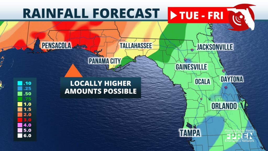
In addition to the risk of wind damage or tornadoes, heavy rainfall is also expected in the western sections of the Florida Panhandle from the multiple rounds of thunderstorms. Forecasters at NOAA's Weather Prediction Center are projecting 2 to 5 inches of rain Wednesday night and Thursday, which may lead to pockets of flash flooding over the 24-hour period.
A new line of thunderstorms is likely to organize along and ahead of an approaching cold front in the Florida Panhandle around daybreak Thursday. Heating of the day and very strong winds through the atmosphere will foster an environment that is favorable for a gradually strengthening squall line as the front moves through a larger portion of North and Central Florida during the afternoon and nighttime hours.
Our best estimate of time of arrival of the squall line is as follows:
The Storm Prediction Center has issued a "slight risk" (level 2 out of a possible 5) for severe thunderstorms from the Orlando and Sarasota areas north and westward. A "marginal risk" (level 1) is in effect on a line from Fort Myers to the Space Coast area, as the line may weaken somewhat early Friday morning. The forecaster’s primary concern is for damaging wind gusts and a few brief tornadoes with the line.
The line of thunderstorms is expected to exit the state later Friday morning. A more tranquil weather regime is forecast to follow the strong front in time for the weekend.


