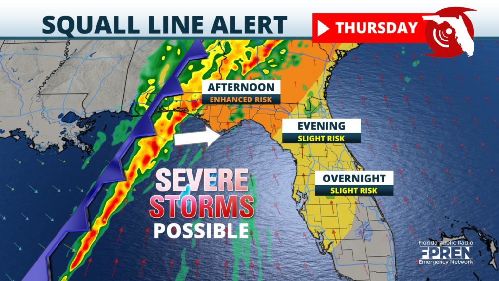
A squall line of thunderstorms is expected to move across the entire state of Florida Thursday and Thursday night, potentially producing damaging wind gusts up to 70 mph, along with very heavy rain. A brief tornado or small hail is also possible from the strongest storm segments along the line.
Latest ETA's of squall line
If you’re in a hurry, the most-likely ETA’s of the strongest thunderstorm activity for select cities or regions throughout Florida are listed below.
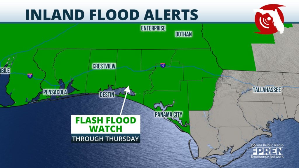
Heavy rain and thunderstorms developed Wednesday afternoon in the western sections of the Florida Panhandle, where localized flooding was reported from 2 to 3 inches of rain that accumulated in just a few hours. This was a precursor to a larger storm system, which is expected to strengthen as it approaches Florida early Friday, and produce several more rounds of showers and thunderstorms near Pensacola and along the Emerald Coast.
A Flash Flood Watch has been issued for the areas shaded in green on the map below.

Although most locations in the Florida Panhandle will be dry overnight, the rounds of heavy rain that return Friday morning will also be capable of producing localized flooding. Rainfall totals in the advised area may exceed four inches from this storm system.
NOAA’s Storm Prediction Center issued a “slight risk” (a level 2 risk) for the potential of isolated tornadoes and damaging wind gusts for Pensacola, Fort Walton, and Destin. An “enhanced risk” (level 3 out of 5) was issued for Panama City, Marianna, Tallahassee, Apalachicola, and surrounding areas for Thursday afternoon, where the greatest risk of strong thunderstorms is expected. A lesser risk, also noted as “slight” (level 2), was in place near and north of a line from Fort Myers to Melbourne for overnight activity.
A powerful cold front, attached to an area of low pressure moving from the Mid-South to the Northeast, will be the triggering mechanism for the strong storms as is sweeps through the Sunshine State. Strong winds aloft, combined with an increasingly moist and unstable air mass near the ground, are expected to produce an environment favorable for the severe storms to develop and maintain intensity for several hours.
Meteorologists at the Florida Public Radio Emergency Network strongly encourage those in the path of these storms to have multiple ways to receive weather alerts Wednesday night into Thursday, should quick protective action be required.
