A Tornado Watch is in effect until 8 PM ET (7 PM CT) for much of the Big Bend and parts of the Florida Panhandle. The watch includes Tallahassee, Panama City, Marianna, Apalachicola, and Lake City.
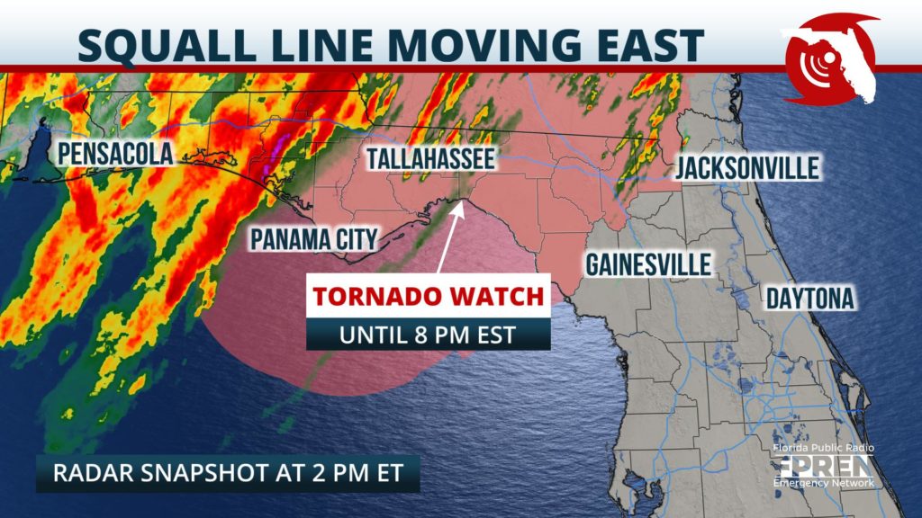
A line of strong thunderstorms was noted to be getting better organized in the Florida Panhandle early Thursday afternoon, and it was beginning to approach Panama City just before 1 pm.
The squall line is expected to intensify as it moves east through the watch area, thanks to strong winds throughout all layers of the atmosphere and an unstable mass is developing ahead of it. The Storm Prediction Center says there is a enhanced risk of damaging winds up to 75 mph and a few tornadoes with the line.
The most likely arrival times of the squall line in the advised area are listed below. Keep in mind that the greatest wind damage potential is usually a few miles ahead of the reflectivity you may see on radar.
In addition to the wind damage potential, rainfall totals between 1 and 2.5 inches may cause pockets of flash flooding where some of the strongest cells track. The heaviest rain is expected to exit the Florida Panhandle by midnight, with clearing skies and cooler conditions expected on Friday.


