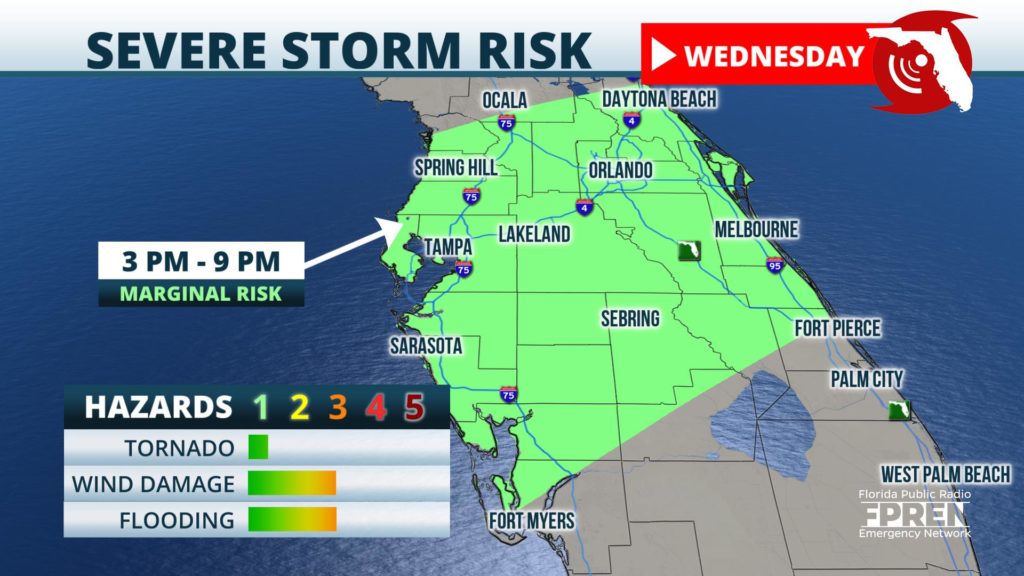
A line of thunderstorms capable of producing damaging wind gusts is expected to barrel through Central Florida Wednesday afternoon.

A humid air mass is in place and an approaching disturbance from the Gulf of Mexico is likely to cause showers and thunderstorms to develop as soon as mid-afternoon Wednesday. High-resolution model simulations are forecasting a small cluster of storms to form between Orlando and Ocala after 1 o’clock. These storms would likely move toward Volusia and Brevard counties by afternoon drive time. Damaging gusts and perhaps an isolated tornado may accompany these thunderstorms if they form as the models are indicating.
An approaching cold front from the Gulf of Mexico is expected to initiate a separate line of thunderstorms this afternoon. The line is forecast to approach the Tampa/St Pete Metro area and the Nature Coast between 2 and 5 PM, and sweep eastward into the Orlando area between 5 and 7 PM. The line should extend as far south as Ft Myers and Port Charlotte between 7 and 10 PM. Strong winds through a deep layer of the atmosphere are supportive of damaging gusts in places along the line. A brief, isolated tornado cannot be ruled out.
The approaching front and warm, humid air may cause additional thunderstorms to form in Southeast Florida between the Treasure Coast and the Gold Coast, and as far south as the Keys, mostly after 7 PM. A few of these storms may also become strong, but a loss of daytime heating may limit the number of wind damage reports in these areas before the storms move off the coast shortly after midnight.
Noticeably colder air will surge into the state Thursday behind the front on the heels of gusty northwest winds.
