Multiple rounds of thunderstorms, each capable of producing heavy rain in a short amount of time, could cause flash flooding in portions of the Florida Panhandle by midweek. A few thunderstorms may also be strong enough to produce hail, damaging winds, and isolated tornadoes Wednesday and Thursday.
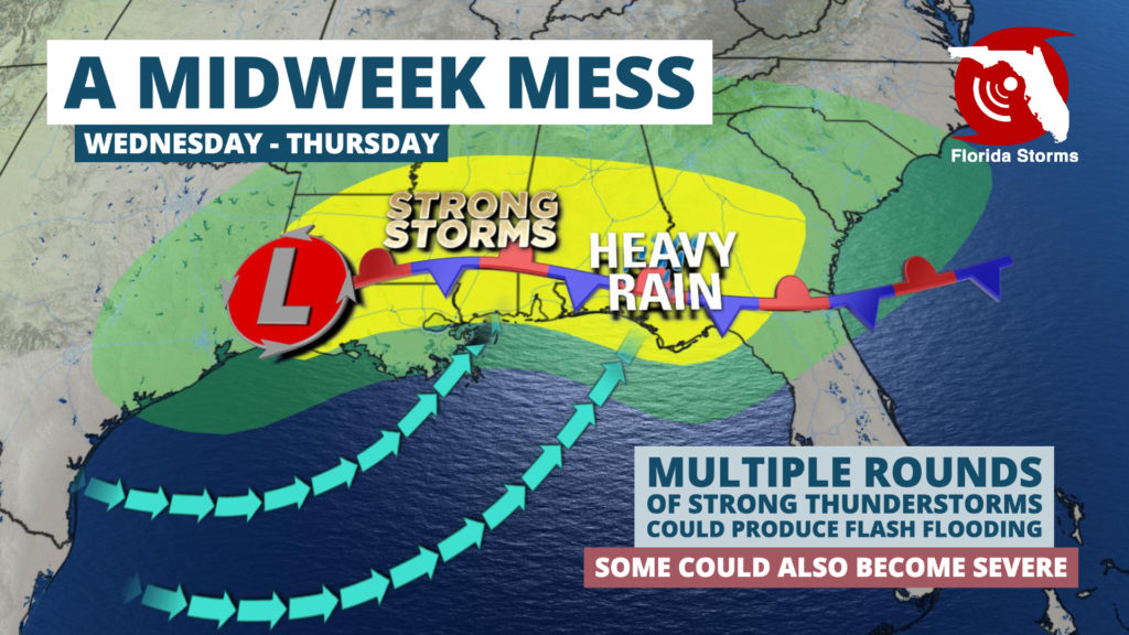
A cold front is expected to become better organized as it moves through the Tennessee Valley Tuesday, then stall across the Florida Panhandle Wednesday morning. Disturbances high in the atmosphere will travel along the front, producing several clusters of thunderstorms in an increasingly warm, humid, and unstable air mass near the Gulf of Mexico. The unsettled weather is likely to continue through Thursday, before the front weakens and moves across the Florida Peninsula Friday.
A few showers could develop as early as Tuesday afternoon across the Florida Panhandle, but the heavier and more widespread activity is likely to hold off until late Tuesday night or Wednesday morning. Additional rounds of thunderstorm activity are then expected Wednesday afternoon and night, before most of it moves a bit farther east into sections of Northeast Florida Thursday.
A few of the thunderstorms may produce hail, damaging gusts, or tornadoes, especially Wednesday afternoon through Thursday morning near and west of Tallahassee. However, there is still some question as to how far inland the most unstable air from the Gulf of Mexico will move. If the heavy rain from Tuesday night and Wednesday morning cools the air mass too much, the chance of tornadoes and damaging winds would be lower Wednesday and Wednesday night. Conversely, if enough humidity and warm air from the Gulf is able to return north, the risk of stronger thunderstorm activity would be greater.
The latest blend of computer model simulations are forecasting anywhere from 1.5 inches of rain in the Tallahassee area to nearly 3 inches near Crestview, Pensacola, and Destin. These amounts reflect area-wide averages, but thunderstorms are almost sure to contribute heavier amounts in some areas. A “worst case” situation – rendered by an ensemble of computer models that create many possible scenarios to meteorologists — are indicating the potential for up to about 5 inches of rain in these areas. This scenario can become more probable where thunderstorms “train” or move over the same areas.
Rainfall totals over the past 30 days in the Florida Panhandle have been running slightly below average for areas south of Interstate 10. However, areas along and north of I-10 have had more rain than usual and may be more susceptible to flash flooding. There is also a chance the Escambia River, which was experiencing minor flooding near Century for a time in February, could return to minor flood stage again if heavy rain falls in its watershed.
Strong thunderstorms or widespread amounts of heavy rain are not expected across central and south Florida from this storm system at this time.


