Beneficial rainfall is on its way to Central Florida Thursday, although it won’t completely erase the region’s moderate drought.
On Wednesday morning, a cold front was observed moving into North Florida from the panhandle and southern Georgia. Several clusters of thunderstorms had developed along the leading edge of the boundary, dumping heavy rain from Cross City to Jacksonville.
The steadiest and heaviest rain that will move across cities such as Tampa, Orlando and Melbourne will not arrive until the front approaches early Thursday . However, some showers and thunderstorm activity is possible over portions of Central Florida as early as Wednesday evening. Later in the day Thursday, the heavier downpours are forecast to move toward the Treasure Coast and Space Coasts, while locations north of I-4 begin to dry out some. The wet weather is then likely to diminish some across Central Florida Thursday night as the front weakens and stalls, but a few showers will remain in the forecast again Friday.
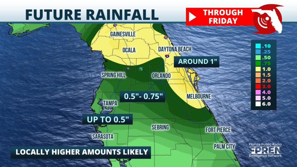
Widespread rainfall accumulations between 1/2 and 1 inch are expected through early Friday. Locally higher amounts will be possible, especially in areas where thunderstorm cells repeat over some of the same areas across east-central Florida. Thursday’s rain is likely to only make a small dent in the recent deficit, as much of Central Florida is between 6 and 8 inches below normal for the year to date. However, long range forecast data suggests a more active pattern could yield several more chances of rain to the region in the next seven days.


