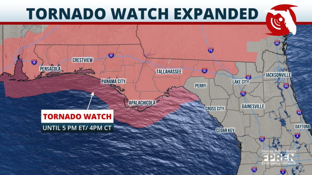
UPDATE 11AM EDT: A Tornado Watch has been extended into western portions of the Big Bend including the city of Tallahassee until 1:00 PM CDT.
As of late Thursday morning, heavy showers and strong thunderstorms were entering extreme northwestern parts of the Florida Panhandle ahead of a strong cold front.
This line of hazardous weather will continue eastward through Thursday late morning and early afternoon. Locations around Panama City will see showers and storms move through by late Thursday morning and early afternoon.
Thursday evening thunderstorms will approach the Tallahassee area close to midnight. This line of storms will likely continue to maintain its strength into the overnight hours.
The main hazards with these thunderstorms will be damaging winds in excess of 70 mph, the potential for large hail, and the possibility of embedded strong tornadoes.
A Tornado Watch is in effect for much of the Florida Panhandle until 1 PM. The watch includes, but is not limited to, the cities of Marianna, Panama City, Crestview, Chipley, Destin, Fort Walton, and Pensacola.
As of early Thursday morning, a line of thunderstorms extended from central and south Alabama into southern Mississippi and a portion of southeast Louisiana early Thursday morning. The storms are moving east at around 45 mph. If they continue at this pace, they will arrive in Escambia and Santa Rosa counties, north of Interstate 10, between 7 and 8 AM. These storms should continue spreading east and reach Pensacola, Fort Walton, Destin, and Crestview between 8 and 11 AM. The Panama City and Marianna areas are likely to see the storms arrive between 10 AM and 2 PM.
Strong wind shear is likely to support damaging wind gusts and tornadoes along segments of the line. NOAA’s Storm Prediction Center said there is a threat for a couple of strong tornadoes as the line of storms interacts with a warm front that is presently near the coast.
A second round of thunderstorms is possible this evening as another disturbance high in the atmosphere approaches the Panhandle from the west. However, it is unclear how strong these storms may be and will depend on how much sunshine can warm the atmosphere after the first round of storms this morning.


