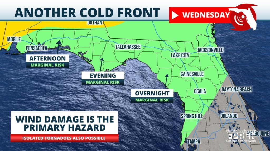
The latest in a series of strong weather systems is set to sweep across the Central and Southern United States during the middle of this week. It is likely to bring at least one line of thunderstorms into much of the state starting Wednesday afternoon in the Panhandle and lasting into Thursday morning over portions of central and south Florida.

Strong winds through a large portion of the atmosphere favor gusty winds as the chief concern with the strongest storms embedded in the line. As of late Tuesday afternoon, the Storm Prediction Center outlined a small risk for tornadoes over the Florida Panhandle Wednesday afternoon and evening.
Here are the most likely times of arrival for selection locations across the state:
Noon to 4 PM Wednesday: Western Panhandle, including Pensacola, Destin, Fort Walton, Crestview
5 to 9 PM Wednesday: Eastern Panhandle, including Panama City, Marianna, Tallahassee
10 PM Wednesday to 3 AM Thursday: North Florida, including Lake City, Jacksonville, Gainesville
10 PM Wednesday to 3 AM Thursday: Central Florida, including Daytona Beach, Orlando, Tampa, Melbourne
2 AM to 10 AM Thursday: South Florida, including Fort Myers, Vero Beach, West Palm Beach, Miami
Some computer models indicate a second line of thunderstorms may move through the Panhandle overnight Wednesday, reaching North Florida during the early daylight hours of Thursday, and finally reaching central and south Florida Thursday afternoon. These storms also have the potential of producing strong wind gusts as they move through the state.
Conditions are expected to improve statewide Thursday night into Friday, followed by a hotter and drier pattern starting Sunday and lasting into early next week.
