A tropical storm that passed more than 400 miles to the west dumped more than a foot of rain and spawned several tornadoes over a three-day period across portions of the Florida peninsula.
Cristobal, which is now a tropical depression and moving into the Midwest, is no longer directly influencing the weather across the Sunshine State, but tropical moisture is forecast to linger for several more days. As a result, numerous showers and thunderstorms are in the forecast through at least Friday, some of which could cause localized flooding.
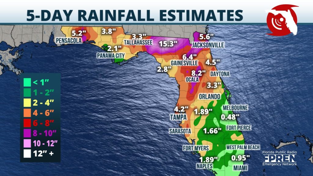
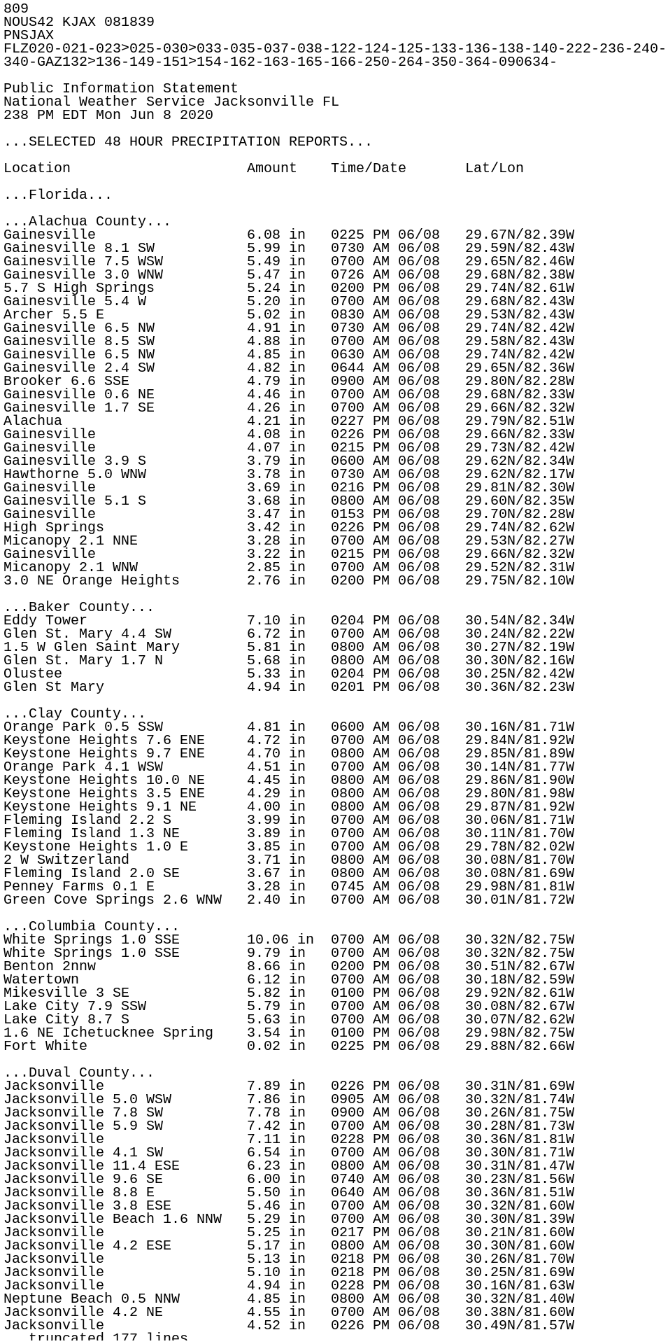
Flooding was severe enough Sunday to prompt the closure of I-10 in Suwannee County, where an estimated 12 to 15 inches of rain accumulated over a 48-hour period. Rainfall estimates elsewhere from Tropical Storm Cristobal ranged from 3 to 7 inches in Northeast Florida, to 1 to 3 inches across much of South Florida.
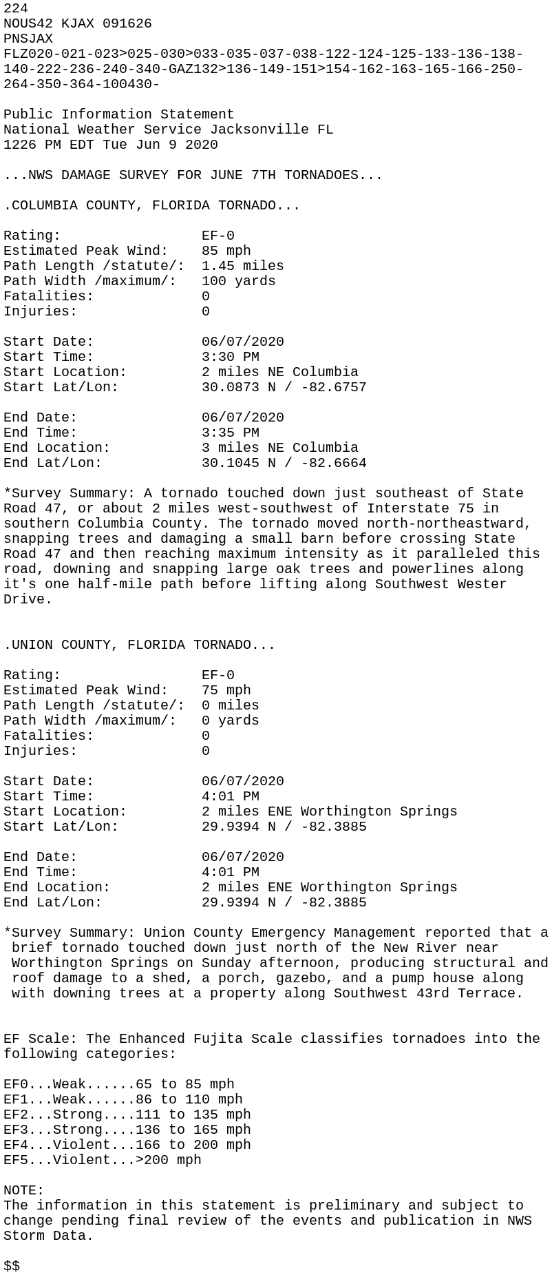
At least five tornadoes were reported across Florida over the weekend from Tropical Storm Cristobal, including and EF1 that moved through downtown Orlando.
Other tornadoes were observed Sunday near Lake City and Lake Butler, which according to the National Weather Service, produced EF0 damage in Columbia and Union counties respectively. This video was sent to us from our Facebook fan Matt Rocco.
The widespread tropical moisture from Cristobal has come to an end across Florida, however, a humid air mass will remain in place for several more days. This moisture will aid in the development of scattered to numerous afternoon showers and thunderstorms, which will be most focused across inland areas of north and central Florida. Locations near Florida’s Big Bend and Suwannee River Valley that have recorded over a foot of rain in the past three days are most susceptible to additional flooding.
On Thursday, a cold front is expected to approach from the west, then stall across North Florida Friday. This will add more lift and energy to an already charged and saturated atmosphere, likely triggering more rounds of mainly afternoon and evening thunderstorms. This will keep elevated rain chances and periodic episodes of localized flooding in the forecast for sections of north and central Florida through at least the start of the weekend.


