Rain chances will be unusually low and nights surprisingly comfortable across the northern half of Florida this week.
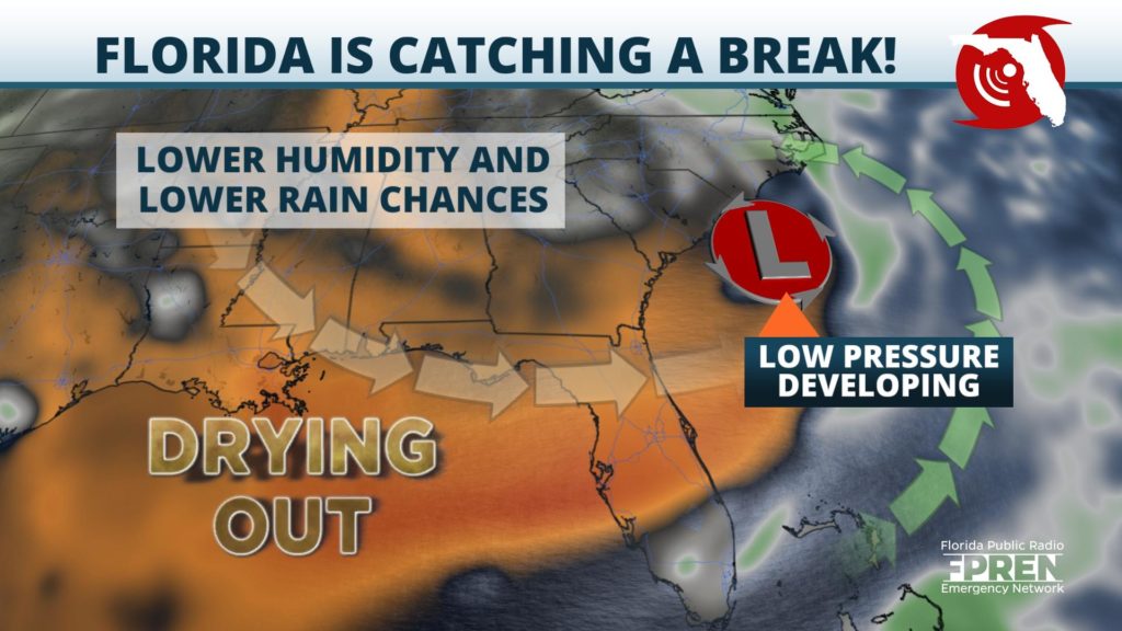
The circulation behind an area of low pressure off the coast of South Carolina has allowed a much drier, and consequently more comfortable air mass to spread as far south as Central Florida. As a result, nearly all of Monday’s showers and thunderstorms were concentrated in South Florida and near the Florida Keys. And this will be a trend that lasts through at least midweek.
Dry northwesterly winds have caused dew points, which are a measure of atmospheric moisture, to fall into the 60s as far south as Tampa and Orlando. Normally they are in the lower and middle 70s for weeks on end this time of year, which makes the already warm summer afternoons feel even hotter. That won’t be the case over the next few days near and north of the I-4 corridor.
The drop in humidity will be most noticeable in the mornings and evenings, as temperatures are allowed to fall faster and to lower levels because of the drier air. Overnight lows across inland areas of the Florida Panhandle and much of North Florida will dip well into the 60s through at least Wednesday morning. Daytime highs will also be a tad cooler as well, rising to the middle and upper 80s in most spots. Both the projected highs and lows will be running roughly 2 to 5 degrees below normal for mid-June.
Rain chances will be well below normal across most of the state this week, with South Florida being an exception where deep tropical moisture remains in place. The showers and thunderstorms will form primarily along sea breeze boundaries over the next few days and could produce heavy rainfall, which could cause localized flooding. A few afternoon showers or thunderstorms might also develop each afternoon farther up the I-95 corridor due to the Atlantic sea breeze, but this activity will remain isolated.
Rain chances will gradually be on the rise across Central and South Florida by Thursday and Friday, thanks to a tropical wave moving north from the Caribbean. However, most areas of North Florida and the Florida Panhandle are likely to stay drier than normal through at least the start of the weekend.


