Update 5 pm Tuesday: Potential paths of #TD7 are closely aligned into the eastern #Caribbean by this weekend, but conditions there are expected to be less favorable. #flwx
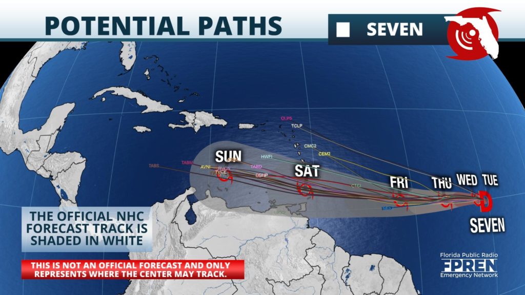
The National Hurricane Center began advisories on Tropical Depression Seven at 5 pm Tuesday. Forecasters noted a "well-defined circulation" and sufficient organization to the convection (showers and thunderstorms) to be designated a tropical depression.
The track forecast is one of reasonable confidence, bringing the system close to the Lesser Antilles by Saturday, then into the eastern Caribbean. However, lower confidence was expressed on the intensity forecast due to how model simulations vary on their extent to which unfavorable environmental conditions may play a role after Friday. The small nature of the cyclone is also likely to make intensity predictions even more challenging, as small systems are often more susceptible to influences from their surrounding environment.
The National Hurricane Center is monitoring two tropical waves for potential development, but neither are a significant or direct threat to Florida over the next five days.
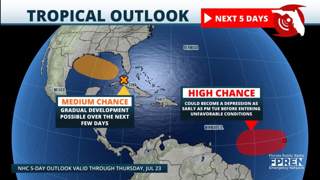
One tropical wave, referred to as Invest 99 by meteorologists, has rapidly organized over the past 24 hours. This system, as of Tuesday morning, was located about midway between the west coast of Africa and the Lesser Antilles. Environmental conditions are expected to be conducive for development as Invest 99 approaches the Lesser Antilles in the next couple of days, and the National Hurricane Center has noted that if current trends continue, it will be classified as a Tropical Depression Tuesday afternoon.
Closer to home, a tropical wave is continuing to move westward through the Florida Straits producing a large area of disorganized showers and thunderstorms over South Florida, the northwestern Bahamas, and western Cuba. Further development of this system is possible especially as the wave enters the Gulf of Mexico late Tuesday. An Air Force Reserve Hurricane Hunter aircraft is scheduled to investigate the system Tuesday afternoon, if necessary. The National Hurricane Center has given this tropical wave a "medium chance" of development over the next five days. Residents who live along the Gulf Coast from Texas to Louisiana are advised to monitor the progression of this tropical wave.


