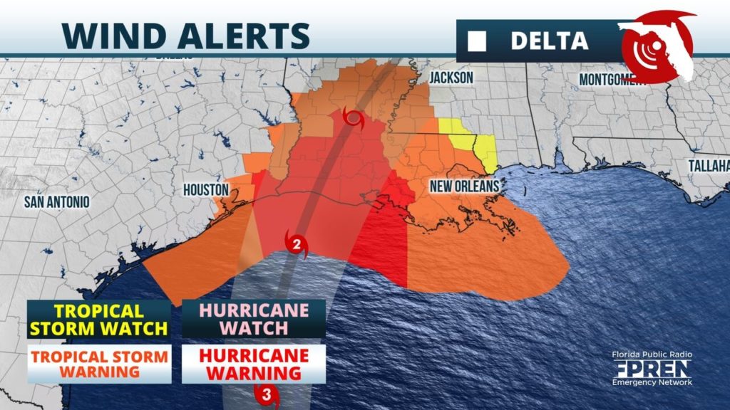
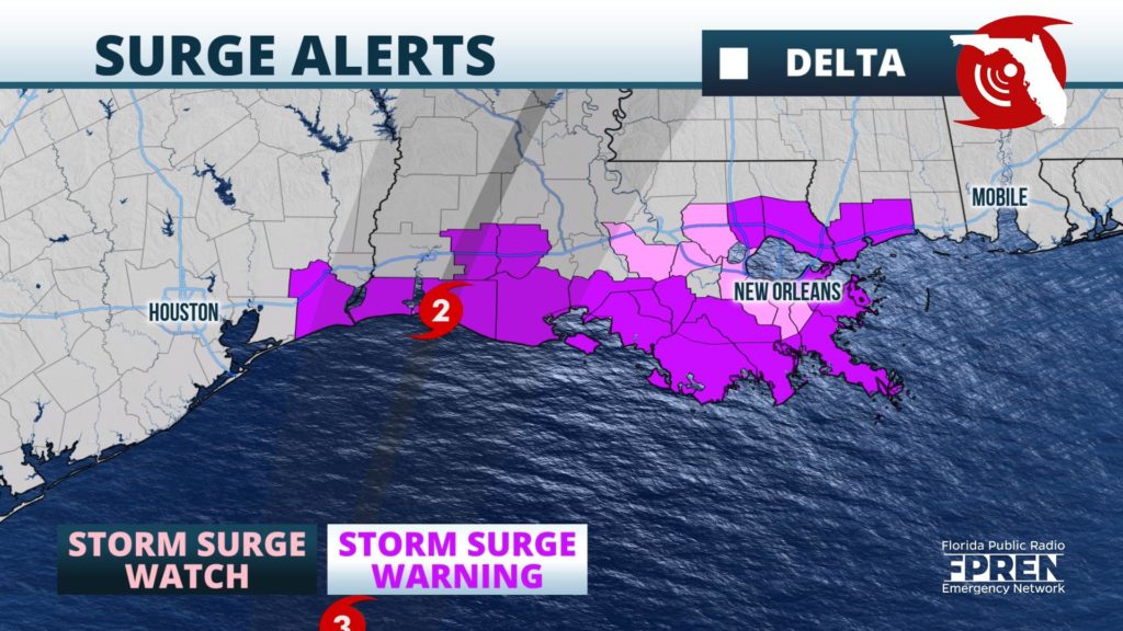
Delta continues its march toward a record-setting 10th U.S. landfall of a named storm in one season. It is expected to bring life-threatening surge, heavy rain, strong winds, and high surf to the Gulf coast on Friday.
Storm Surge Warnings were issued ahead of Delta from Sabine Pass, TX to Ocean Springs, MS, where peak surges of 7 to 11 feet above normally dry ground were anticipated somewhere in the warning area. Hurricane Warnings continued for much of the central and western Louisiana coastlines, while Tropical Storm Warnings were in effect as far west as San Luis Pass, TX and as far east as the mouth of the Pearl River in Mississippi.


After weakening to a category 1 hurricane Wednesday, the hurricane regained category 2 status over the warm Gulf waters early Thursday. As of the early morning forecast, Delta was expected to regain category 3 status Thursday night or Friday morning before weakening slightly to by landfall Friday afternoon.
Cooler water, stronger wind shear, and dry air near the coast may cause Delta to weaken some as it approaches the coast on Friday, but it is expected to cause potentially life-threatening impacts to the coastline. The geographic extent of Delta’s hurricane and tropical storm force winds have expanded. Tropical storm force winds extend 125 miles from the center and those winds were most likely to reach the Louisiana coast at first light on Friday.
As is often the case with landfalling hurricanes, isolated tornadoes and flash flooding is likely. Widespread rain of 5 to 10 inches is forecast over portions of Louisiana, with a few places receiving as much as 15 inches. Totals of 3 to 6 inches with locally higher amounts are forecast over Mississippi and Arkansas and into the Tennessee Valley to start the weekend. The greatest chance of tornadoes is over Louisiana and Mississippi, but some threat of tornadoes exists as far inland as Alabama and southern middle Tennessee on Saturday.
Outer fringe rain bands are possible as far as the Florida Panhandle and Georgia Saturday and into the Tennessee Valley and the Carolinas by Sunday. Forecasters at National Weather Service offices along the Gulf coast said dangerous rip currents and high surf are expected to make conditions hazardous for those entering the water Friday and Saturday.
