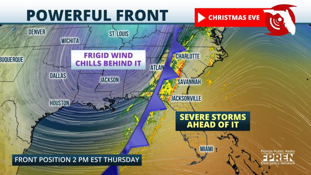
A powerful cold front is expected to sweep through Florida Christmas Eve, producing dangerous thunderstorms ahead of it and frigid wind chills behind it on Christmas Day.

A squall line of thunderstorms capable of producing destructive winds is expected to develop ahead of the advancing cold front before dawn Thursday morning across the northern Gulf Coast states. The storms are likely to arrive in Pensacola and along the Emerald Coast between 6 and 9 am CST, then sweep into the Panama City and Tallahassee regions closer to midday. Wind damage and a brief tornado will be the primary hazards from the strongest storms in the Florida Panhandle.
Farther east, numerous strong thunderstorms are also expected across the Florida Peninsula Thursday afternoon and evening as the front marches in. Wind gusts up to 60 mph and a brief tornado are also possible with the strongest storms, in particular ones that develop ahead of the aforementioned squall line later in the day. Areas most at risk for this second cluster of severe storms are across sections of northeast and east-central Florida, or roughly near and east of a line from Jacksonville to Ocala to Orlando.
The cold front is forecast to clear Florida by Christmas morning (Friday), with frigid wind chills and multiple freezes likely to follow in some areas through the weekend. Rapidly falling temperatures will be noticed first across the Florida Panhandle behind the front Thursday afternoon. For example, after a morning high temperature close to 70 in Panama City, the mercury will likely plummet into the 40s by 4 pm and wind gusts of 20 to 30 mph will make it feel more like the 30s (with the wind chill) by sunset.
The early winter chill will reach all the way to the Florida Keys and Miami by Friday afternoon, where temperatures will struggle just to hit 60 degrees. Farther north, a light freeze is expected Christmas morning across inland areas from Pensacola to Jacksonville, and Friday afternoon highs in these areas will only be in the 40s. Subfreezing temperatures are expected even farther south Saturday morning, potentially reaching Ocala, The Villages, and the northern suburbs of Orlando and Tampa.
Temperatures will gradually moderate across Florida over the weekend as the high pressure system sponsoring the cold blast moves off to the east. An easterly flow is likely to develop by Sunday and Monday, allowing for mild and relatively calm weather to return for several days.
