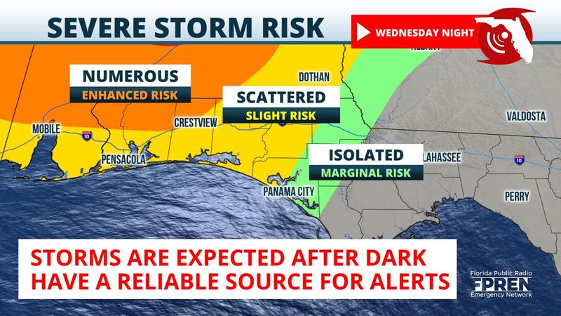
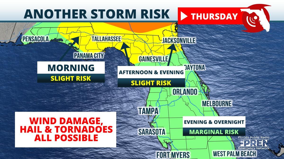
A strong storm system that is expected to produce an outbreak of tornadoes and damaging winds over Alabama, Mississippi, and Georgia could also produce a few instances of severe weather in parts of the Panhandle and North Florida late Wednesday night into Thursday.

An extensive area of warm, humid, and unstable air will flow northward from the Gulf of Mexico on Wednesday. The winds high in the atmosphere are still strong in the spring months and, in concert with unstable air mass, are likely to contribute to a severe weather episode over the Deep South. Thunderstorms with hail, damaging winds, and strong tornadoes are most likely to form over east Texas, Arkansas, and Louisiana around midday Wednesday and spread eastward into Mississippi and Alabama late Wednesday afternoon and night. It is possible scattered showers and storms could produce reports of damaging weather as soon as Wednesday afternoon in the Florida Panhandle, near the Alabama state line; however, the greatest threat is likely to hold off until late Wednesday night.
The cold front attached to this storm will approach the Panhandle during the wee hours of Thursday morning. The storms over Louisiana and Mississippi are likely to congregate into a squall line as they move into the Panhandle from Pensacola to Panama City between midnight and sunrise Thursday. Damaging wind gusts and a few tornadoes could be embedded within the line. If severe weather occurs in the Tallahassee area, it's more likely to occur some time Thursday morning. Thunderstorms are likely to be in the Lake City, Gainesville, and Jacksonville areas Thursday afternoon. Strong wind gusts are possible, but it is unclear whether the storms will be as strong over such a large area as they move eastward along the I-10 corridor.

