English English Spanish Español
Powered by WUFT
Temporarily change filter
Finding your station
THIS STORY HAS EXPIRED

Tornado Watch Issued for Portion of Florida's Panhandle, Big Bend

A line of thunderstorms moving through the Florida Panhandle early this morning intensified some, and has prompted the issuance of a Tornado Watch for the Big Bend and eastern Panhandle area until 1 PM. The Tallahassee metro area is included in this watch.

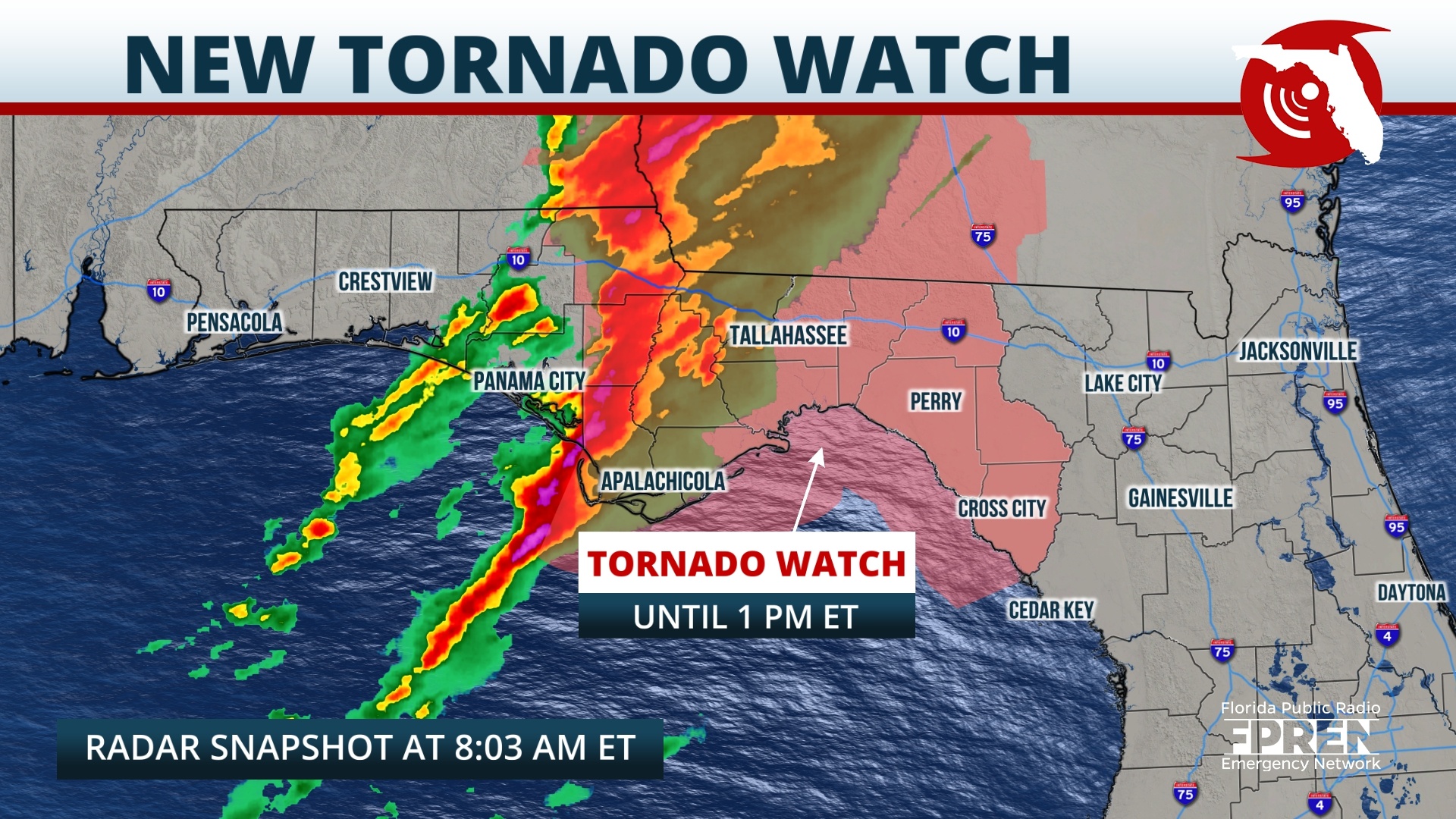
The storms are likely to be in the Tallahassee area between 9 and 11 AM before moving eastward into the Big Bend early this afternoon. A few of the storms within the line are capable of producing damaging, straight-line gusts and isolated tornadoes.

An official wind gust of 74 mph was recorded at the Northwest Florida Beaches International Airport in Panama City at 6 AM CT this morning as the storms rolled through. 

LOCAL ALERTS
WEATHER
NEWS
TRAFFIC
Sources include nearest National Weather Service office, National Hurricane Center, and the Florida Public Radio Emergency Network (@FloridaStorms).
Sources include nearby emergency management agencies, FEMA, and your local NPR affiliate. 
Sources include the Florida Department of Transportation, Florida Highway Patrol and other nearby traffic information.

1885 Stadium Road
PO Box 118405
Gainesville, FL 32611
(352) 392-5551

A service of WUFT at the University of Florida College of Journalism and Communications 

Partners of the Florida Public Radio Emergency Network include: Florida's Division of Emergency Management, WDNA (Miami), WFIT (Melbourne), WMFE (Orlando), WFSU (Tallahassee), WGCU (Fort Myers), WJCT (Jacksonville), WKGC (Panama City), WLRN (Miami), WMNF (Tampa-Sarasota), WQCS (Fort Pierce), WUFT (Gainesville-Ocala), WUSF (Tampa), WUWF (Pensacola) and Florida Public Media.

Loading...
linkedin facebook pinterest youtube rss twitter instagram facebook-blank rss-blank linkedin-blank pinterest youtube twitter instagram