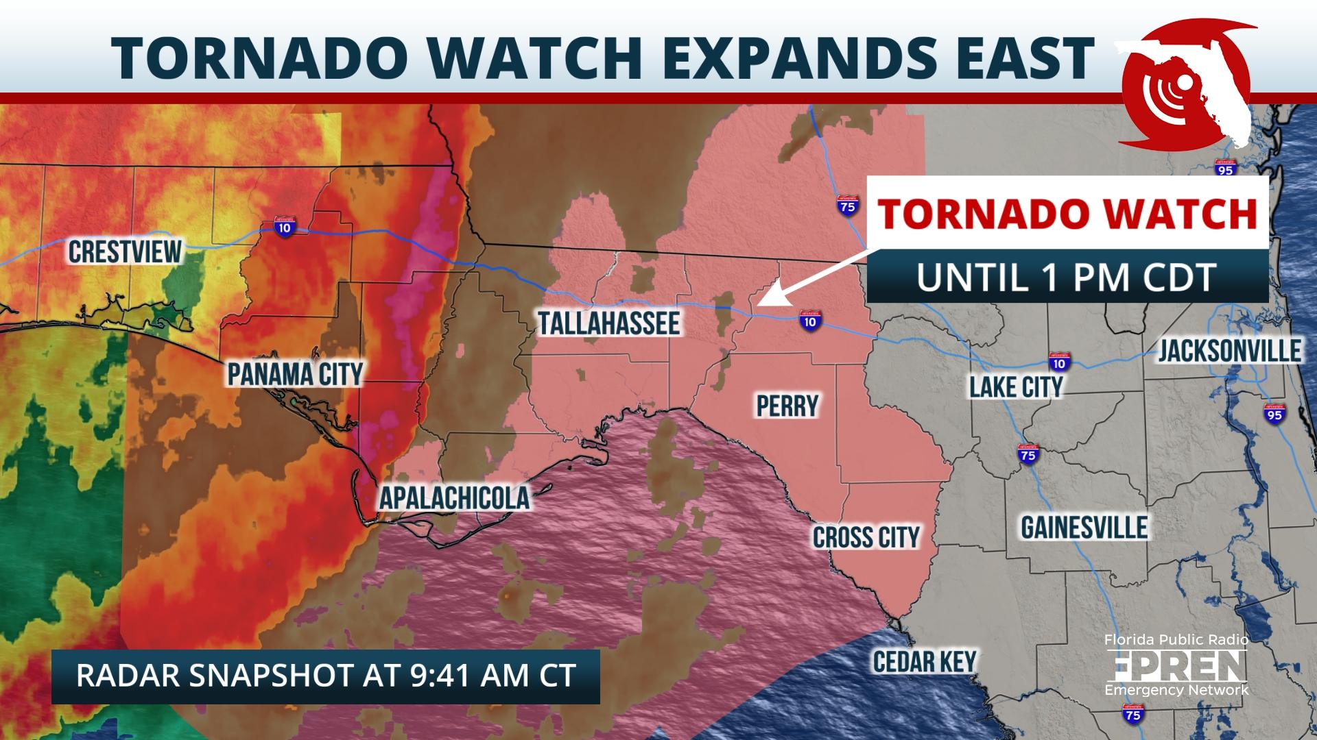
A Tornado Watch continues for portions of the Florida Panhandle ahead of a line of storms with a history of producing destructive winds and possible tornadoes.
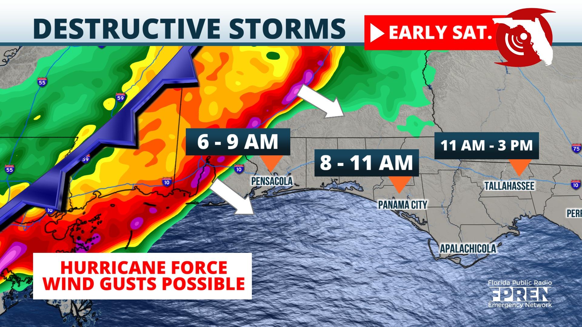
Destructive winds gusts up to hurricane force are possible in the Florida Panhandle early Saturday morning from a line of intense thunderstorms racing in before sunrise.
A tornado is also possible, along with flash flooding where soils are already saturated from heavy rain that fell Friday.
A strong atmospheric disturbance over New Mexico Friday morning is forecast to move eastward along the Gulf coast Friday night into Saturday. A very warm, humid, and unstable environment is expected to stream northward ahead of this disturbance. Thunderstorms are likely to erupt over Oklahoma and Texas Friday afternoon and organize into a formidable squall line over parts of Mississippi and Alabama Friday night.
High-resolution model simulations are indicating this line is likely to hold its strength into the Florida Panhandle during the pre-dawn hours of Saturday into Saturday morning. This line has the potential to produce hurricane-force wind gusts as it moves through the Panhandle during this time. There is also the possibility that storm cells may develop in front of the squall line early Saturday morning, and these individual cells are capable of producing isolated tornadoes, as well.
Areas of flash flooding are becoming more probable with the frequent rounds of rain and storms. Widespread rainfall amounts of 2 to 5 inches, with locally higher amounts, could easily cause flooding of roadways. The National Weather Service in Tallahassee said that minor river flooding could gradually develop later this week along the Chipola, Apalachicola, and Ochlockonee Rivers if enough rain falls upstream of these rivers Friday into Saturday.
After a break in the weather later Saturday afternoon, another round of showers and storms is possible over the Panhandle late Saturday night into Sunday morning. There is greater uncertainty on a possible third round of thunderstorms, but early indications are the threat of damaging storms is lower with a possible final round early Sunday. Drier conditions are expected late Sunday afternoon into Monday over the Panhandle, but rip currents could continue to pose a danger to swimmers in the Gulf of Mexico this weekend.


