A Severe Thunderstorm Watch has been issued for central parts of the Florida Peninsula until 4:00PM EST.
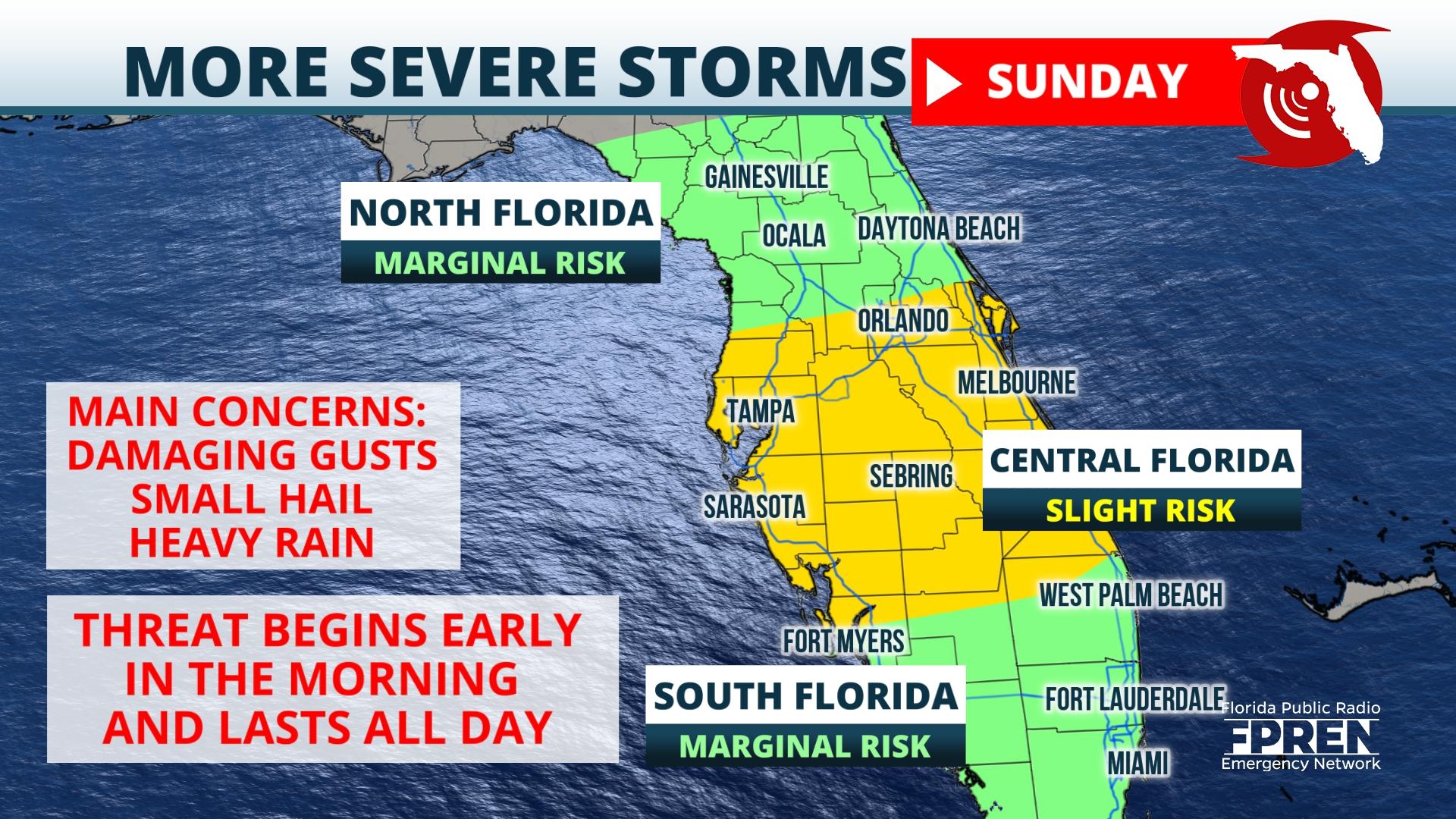
The watch area extends from southern parts of the Big Bend, across to the Atlantic coastlines, and down to the north of the Lake Okeechobee area. Major metropolitan cities include, but are not limited to: Tampa, Orlando, Daytona, St. Petersburg, and Melbourne.
A squall line is expected to develop over the Gulf of Mexico Sunday morning and approach Gulf coast areas by the mid to late morning. Ahead of this line, strong, potentially damaging winds will be possible, with winds in excess of 60 mph. Small hail and isolated tornadoes will also be possible as these storms move through the region.
A Severe Thunderstorm Watch means that atmospheric conditions are conducive to create thunderstorms which may reach severe levels. Make sure that you have multiple way to receive weather warnings today and seek shelter as these storms move through.


