April is climatologically one of the driest months of the year in Florida, but many parts of the state will experience multiple rounds of heavy rain and strong storms through at least Tuesday.

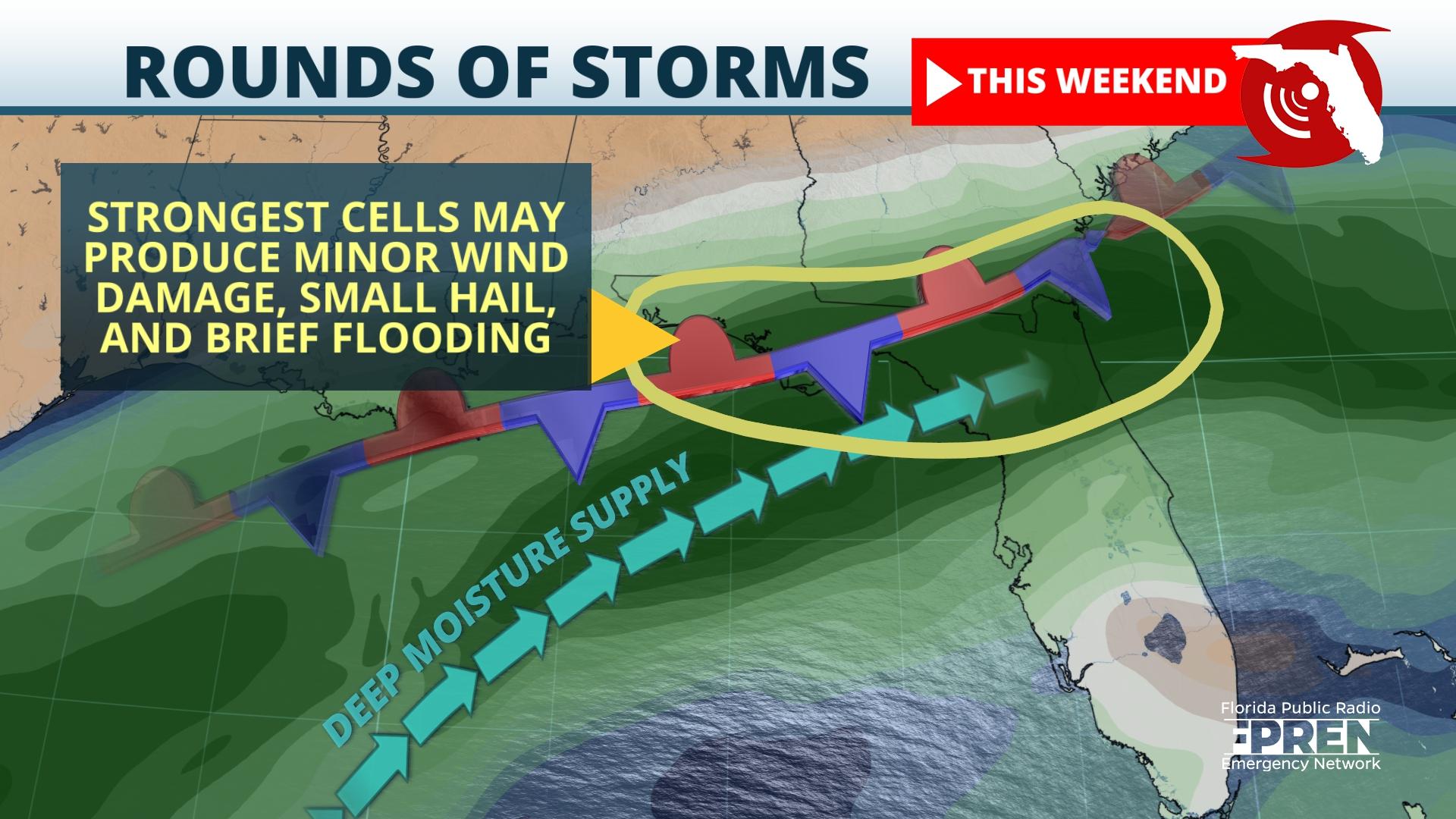
The first round of thunderstorms is expected Friday afternoon and evening along the coast of Florida Panhandle and into the central and north Florida Peninsula, primarily between Interstate 4 and Interstate 10. Areas from the Nature Coast to Ocala, The Villages, Daytona, and perhaps as far south as Tampa and Orlando, are most likely to feel the effects from this initial round. Heavy rainfall and localized flooding are possible and a few of the stronger storms may contain hail or strong wind gusts.
A second round is likely overnight Friday into Saturday morning along the Interstate 10 corridor from the Panhandle to Jacksonville. This second round may also affect a portion of the Nature Coast, Gainesville, Ocala, and Daytona. Heavy rain and early morning thunder may awaken some in these areas. There is again the chance of hail in some of the strongest storm cells.
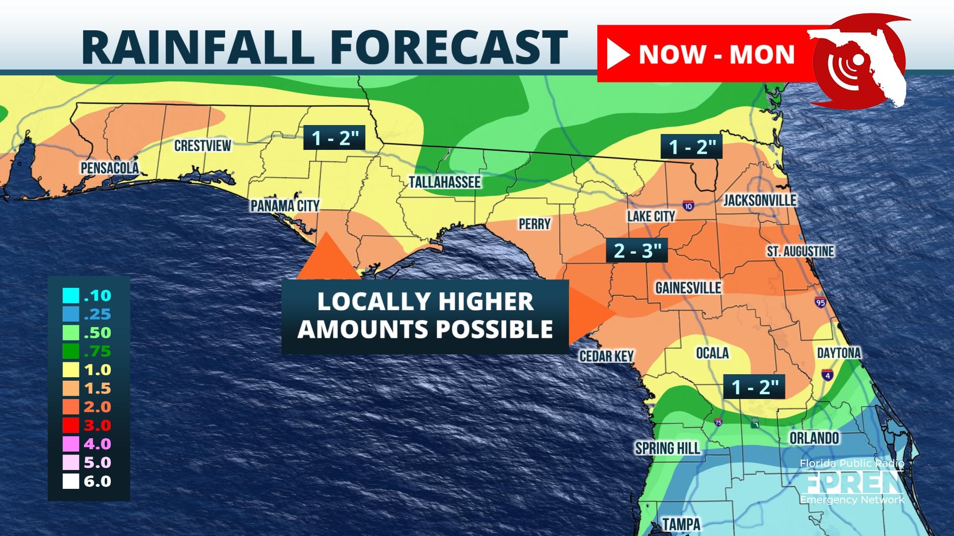
It is normally more difficult to pin down the exact timing of the storms farther into the future, but most computer models agree that scattered to numerous thunderstorms will be most concentrated north of Interstate 4 Saturday night into Sunday, before sinking south and affecting Tampa/St Pete, Orlando, Daytona, and the Space coast more directly Sunday night into Monday and lasting through at least Tuesday. Widespread rainfall totals of 2 to 4 inches are expected, and locally higher amounts are probable in neighborhoods where the strongest thunderstorms happen.

Scattered showers and storms are possible this weekend over South Florida this weekend, but the greatest risk of more widespread rain is between Tuesday and Thursday of next week. Based on data from Friday, heavy rain is likely to be more hit or miss over Southwest and Southeast Florida, including the Treasure Coast. However, localized flooding can still occur underneath the downpours at any time.
There are signs that favor a drier pattern over most of the state Thursday and Friday of next week once the front clears the state.
