Many communities in Central and South Florida escaped drenching rain over the weekend, but that is already changing to start the new week.
Bands of showers and thunderstorms moved onshore the Nature Coast and the Sun Coast late Sunday afternoon and evening. One storm prompted a tornado warning in a portion of Pinellas, Pasco, and northern Hillsborough counties shortly before 9:30 Sunday evening. As of Monday morning, a tornado had not been confirmed in the warned area.
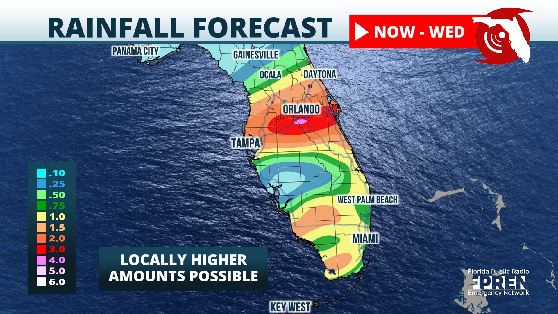
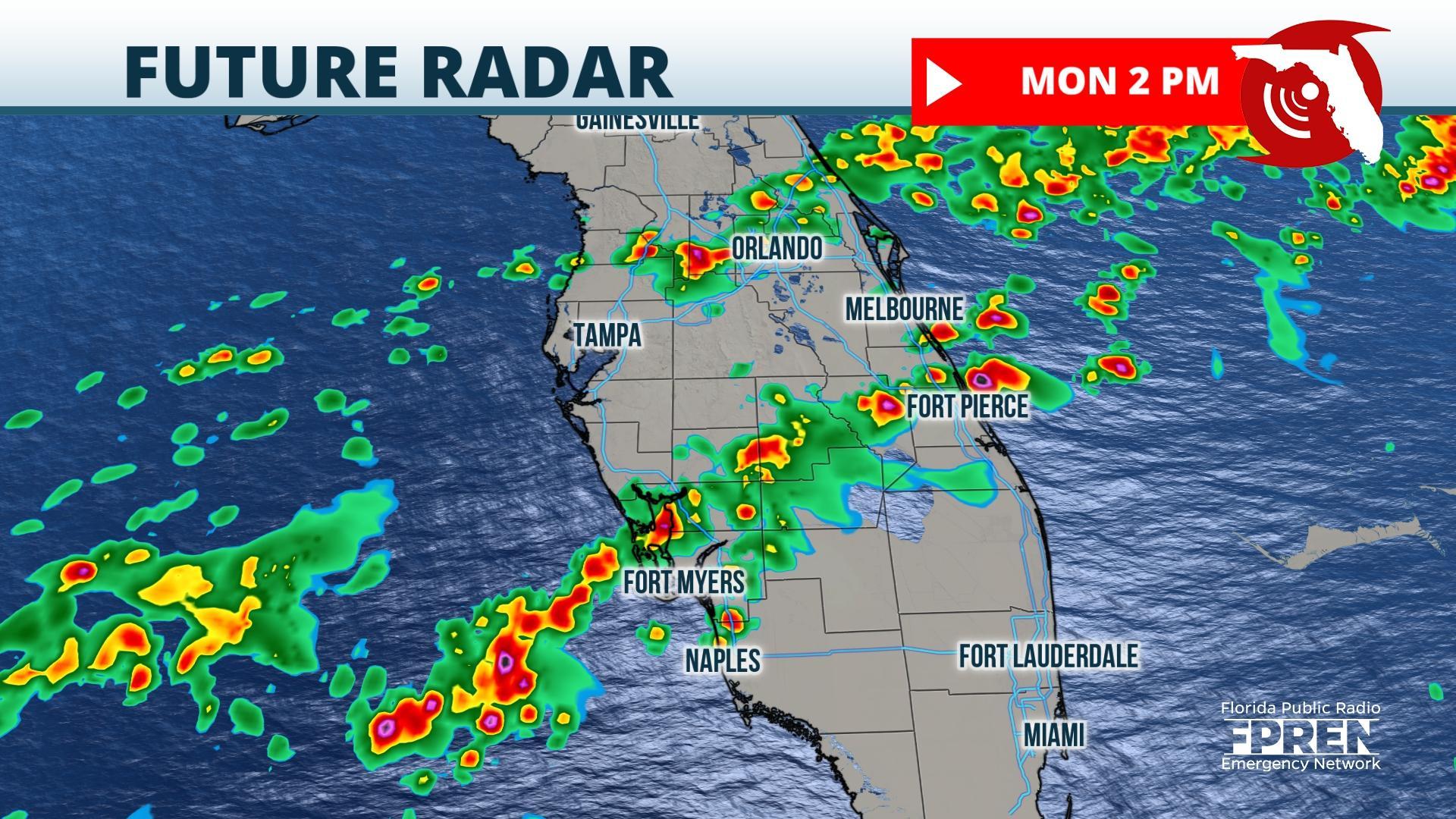
Other storms produced pockets of wind damage near Bronson in Levy county and 3 miles west of Ocala on Sunday. By far, the largest impact from the storm has been heavy rainfall. Radar and rain gauges indicated that 2 to 5 inches had fallen over a wide area from Levy and Citrus counties through Marion into Flagler and Volusia counties through Sunday evening.Occasional showers and thunderstorms are expected Monday over Central Florida, but the heaviest is likely to concentrate from Lee and Charlotte counties to the Florida Heartland and eastward toward the Treasure Coast. These areas have the greatest chance for areas of flooding, gusty winds, and perhaps an isolated tornado.
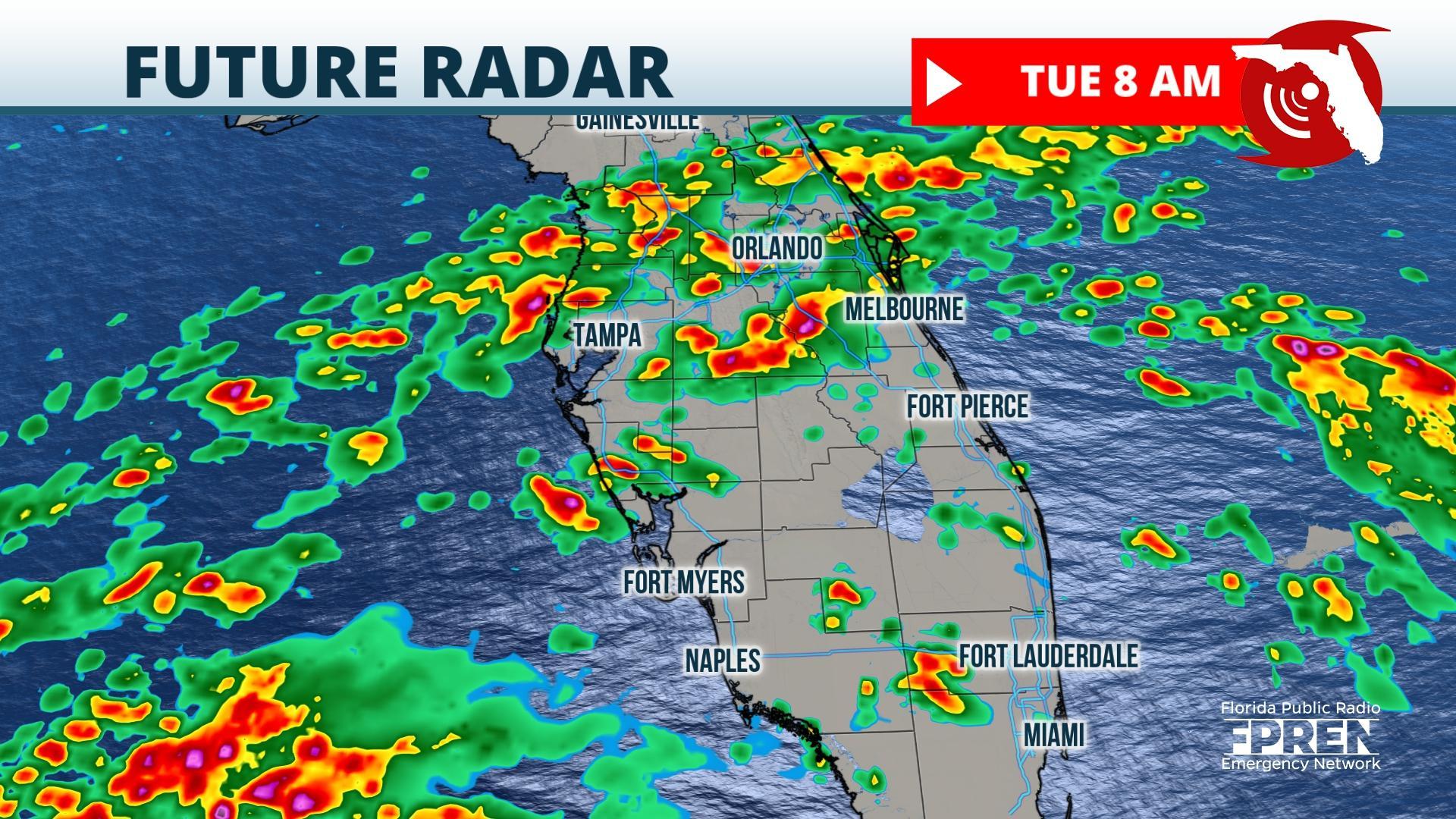
Another upper-air disturbance over Texas is on track to reach Florida on Tuesday. The first showers and thunderstorms from this approaching weather system are expected to start during the wee-hours of Tuesday morning along the Nature Coast and spread eastward after dawn through I-4 corridor all the way to the Atlantic coast. An additional 1 to 3 inches of rain is expected Tuesday. Scattered to numerous storms may deposit locally heavy rain in Southwest Florida and along the Gold Coast, but the heaviest is most probable in Central Florida. Much like Sunday night, a few of the strongest storms may be capable of strong, locally damaging winds, hail, and perhaps an isolated tornado on Tuesday.
The focus for the heaviest rain and storms is expected to shift south again on Wednesday. South Florida will have the greatest chance of showers and thunderstorms, while areas farther north begin to dry out. A few more storms are possible Thursday, particularly in Southeast Florida, before the weather mostly dries out by Friday for nearly all of the peninsula.


