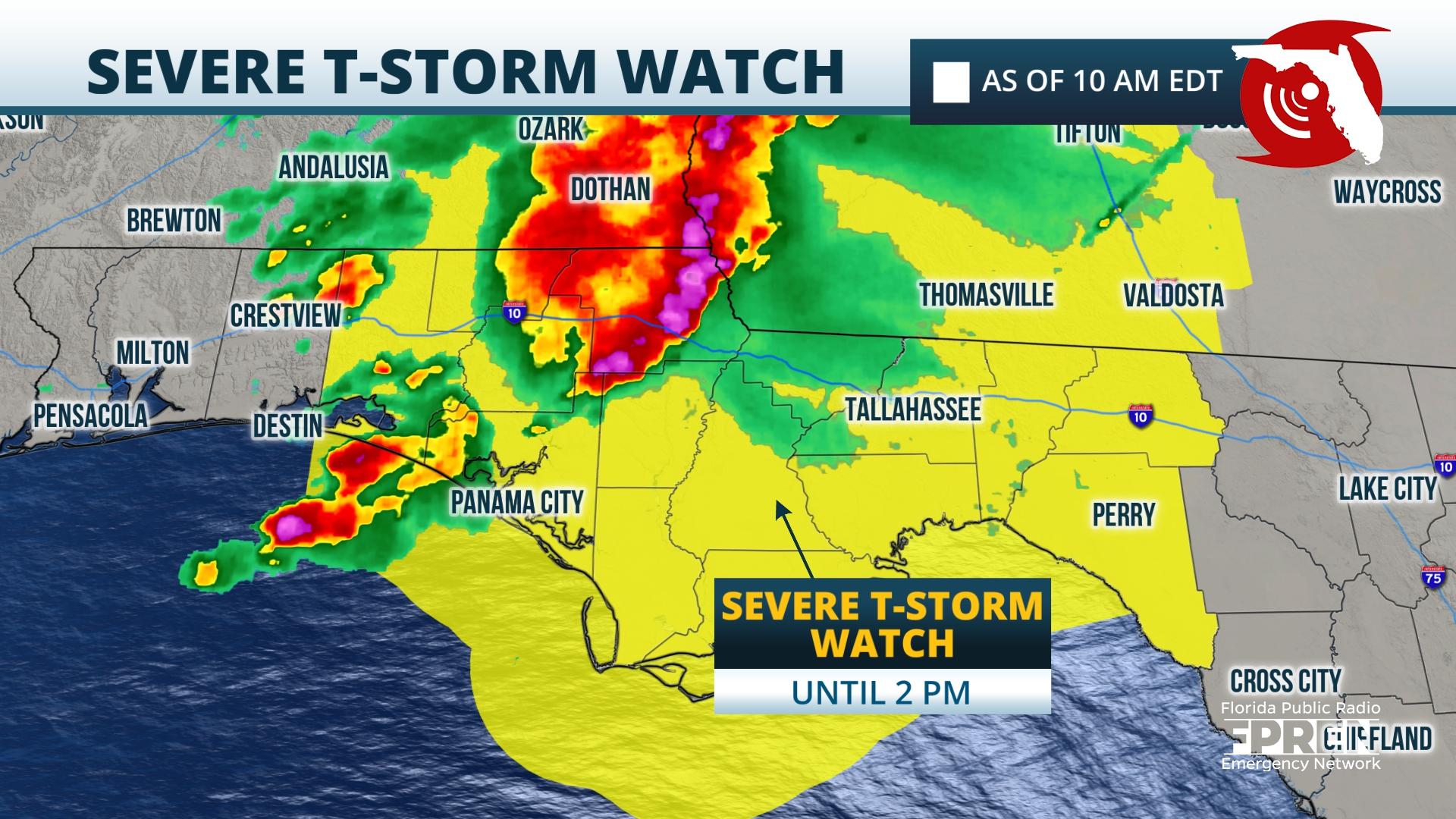
A line of heavy thunderstorms moving through the Panhandle is capable of producing areas of wind damage late Wednesday morning into early Wednesday afternoon. A Severe Thunderstorm Watch has been issued until 2 PM ET / 1 PM CT.
The line of thunderstorms was already responsible for a 58 mph wind gust at Pensacola International Airport shortly after 7 AM CT. The National Weather Service had issued several Severe Thunderstorm Warnings in Escambia, Santa Rosa, Okaloosa, and Walton counties early this morning. Those warnings extended into the Panama City as of 9 AM.
Strong, damaging wind gusts are the primary hazard as the line heads toward Marianna and Tallahassee late this morning and into the eastern Big Bend early this afternoon. Torrential rainfall may also cause areas of flash flooding, making conditions dangerous for motorists.
The line of storms is expected to move eastward toward Live Oak and Lake City by the middle of Wednesday afternoon. Scattered storms and a few storms are possible over the Panhandle into Wednesday evening before drier air arrives overnight Wednesday into Thursday.


