Rain chances will be on the rise this weekend across the Florida Panhandle and northern third of the peninsula, where abnormally dry conditions have recently been observed. Tropical moisture may also spread across the rest of the state early next week, although a significant threat from a tropical storm is unlikely.
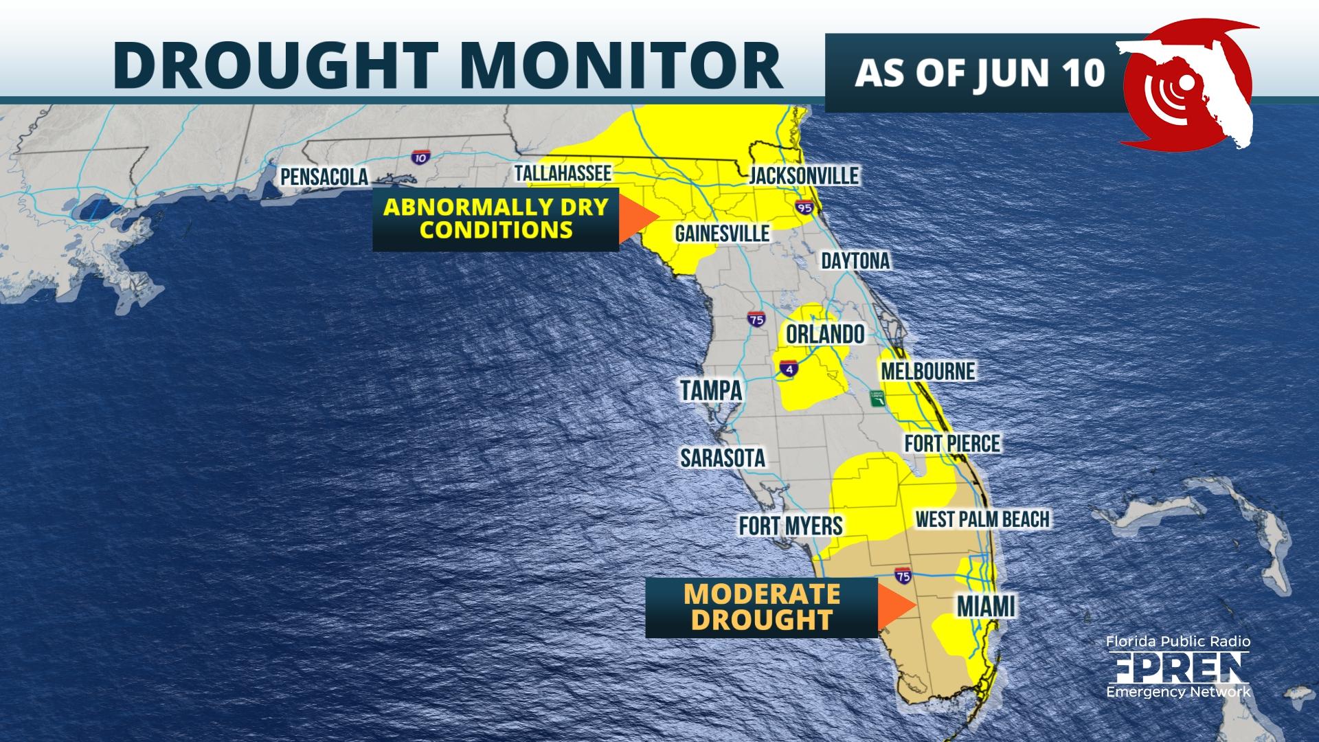
The rainy season began late and has been underwhelming so far this year in The Sunshine State. Drought conditions have persisted in South Florida, abnormally dry conditions have spread across much of North Florida, and only some of the deficit has been erased across central Florida, this according to the latest Drought Monitor released by the National Drought Mitigation Center on Thursday.
A shift in the winds this weekend to be more out of the southwest will allow deeper levels of moisture to move across Florida. A weak front will also be approaching from the north late Saturday and Sunday, triggering numerous showers and thunderstorms ahead of it. Since the front is unlikely to move much farther south than the I-10 corridor and likely dissipate by early next week, the broad southwest flow will remain across the state for several days. This could also lead to higher rain chances across central and south Florida beginning Monday.
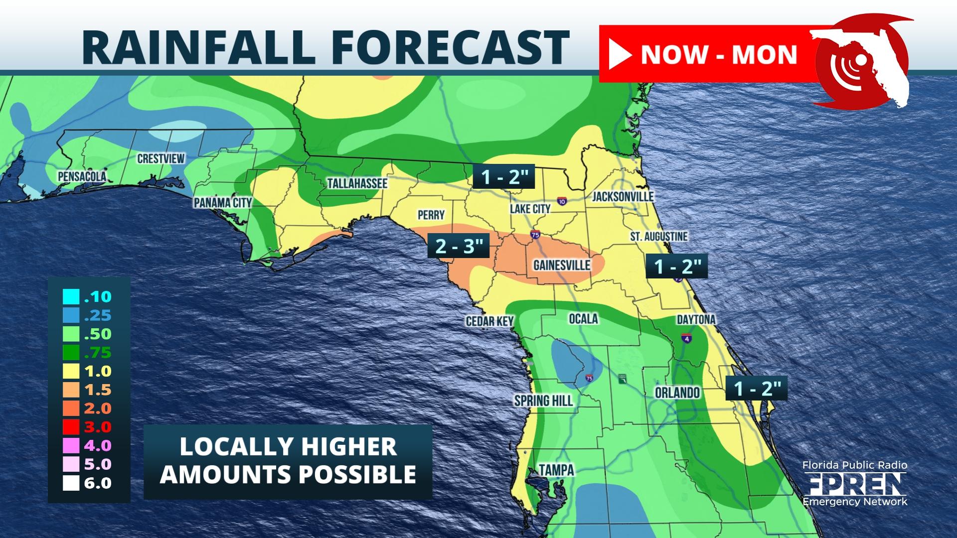
Rainfall accumulations this weekend will be highest in North Florida from the Big Bend to the First Coast, where two to three inches could fall in spots by Monday. This includes cities such as Lake City, Gainesville, Ocala and Jacksonville. Widespread amounts of one to two inches are likely across the Panhandle and along the Nature Coast. More areas will likely stay dry than receive rain this weekend along and south of the I-4 corridor, although spotty activity may still occur in these areas.
There are no threats of a tropical storm affecting Florida in the next five to seven days. However, long range forecast data suggests a system might develop in the western Gulf of Mexico by the middle of next week. If this were to occur, the southwesterly flow on its eastern side would likely continue to influence the weather pattern over Florida and keep rain chances higher than normal for several days.


