A slowly-developing area of showers and thunderstorms over the far southern Bay of Campeche is expected to bring the risk of flooding to a portion of the already water-logged Gulf coast this weekend.
The National Hurricane Center says there is a high potential of the disturbance becoming a depression or named storm late Thursday or Friday. So far, the system has moved little. It is expected to move northward beginning on Thursday in between two ridges of high pressure, one over the Southwestern U.S. and the other over the western Caribbean and South Florida.
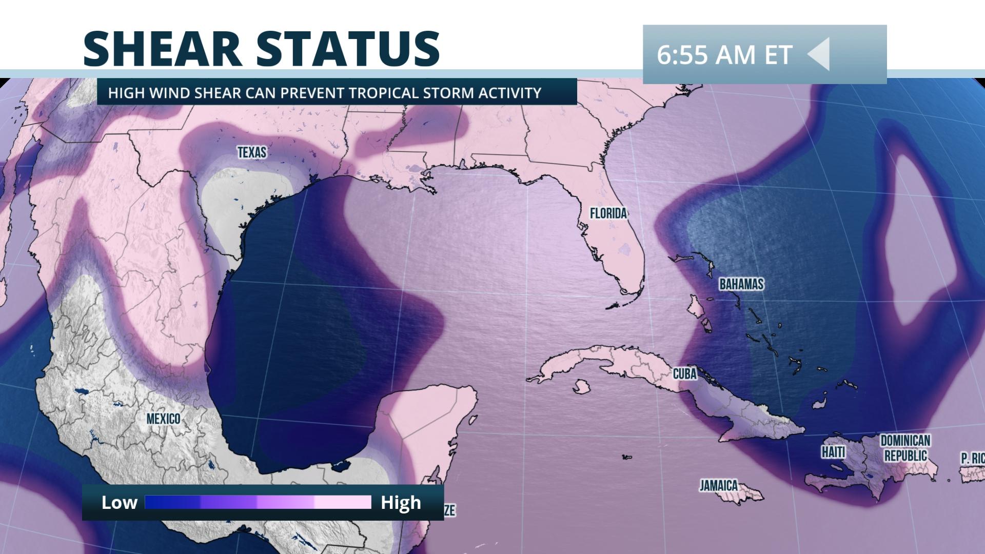
Strong upper-level winds and dry air on the disturbance's western flank should prevent this system from rapidly strengthening. Instead, abundant moisture on the eastern side of the circulation is likely to bring locally heavy rainfall a portion of the Gulf coast, particularly from Louisiana eastward to the Florida Panhandle.
Forecasts from NOAA's Weather Prediction Center indicate to 5 to 10 inches of rain may fall in these areas, with locally higher amounts. Above normal rain has been observed this spring along this section of the Gulf, and sections of coastal Louisiana and Mississippi have received more than double their average rainfall since the start of March.
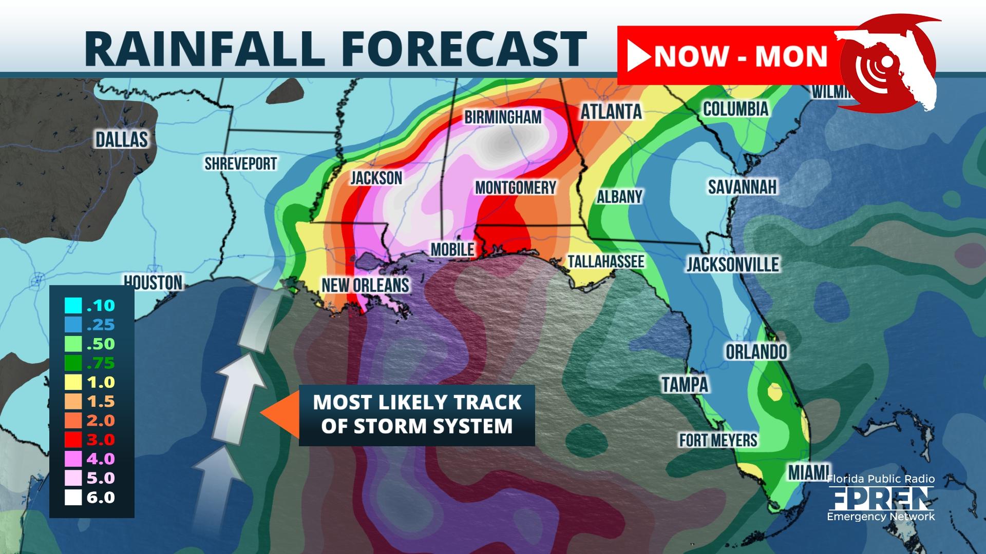
Rain from the developing system may start as soon as Friday, but is likely to be heaviest Friday night into Saturday. Heavy rain may spread from Georgia into the Carolinas on Sunday or Monday before the remnant circulation of the storm departs on Tuesday.


