Deeper moisture is back on the move into Florida this week, making way for numerous thunderstorms to replace the recent stretch of drier weather over the next few days across most of the state.
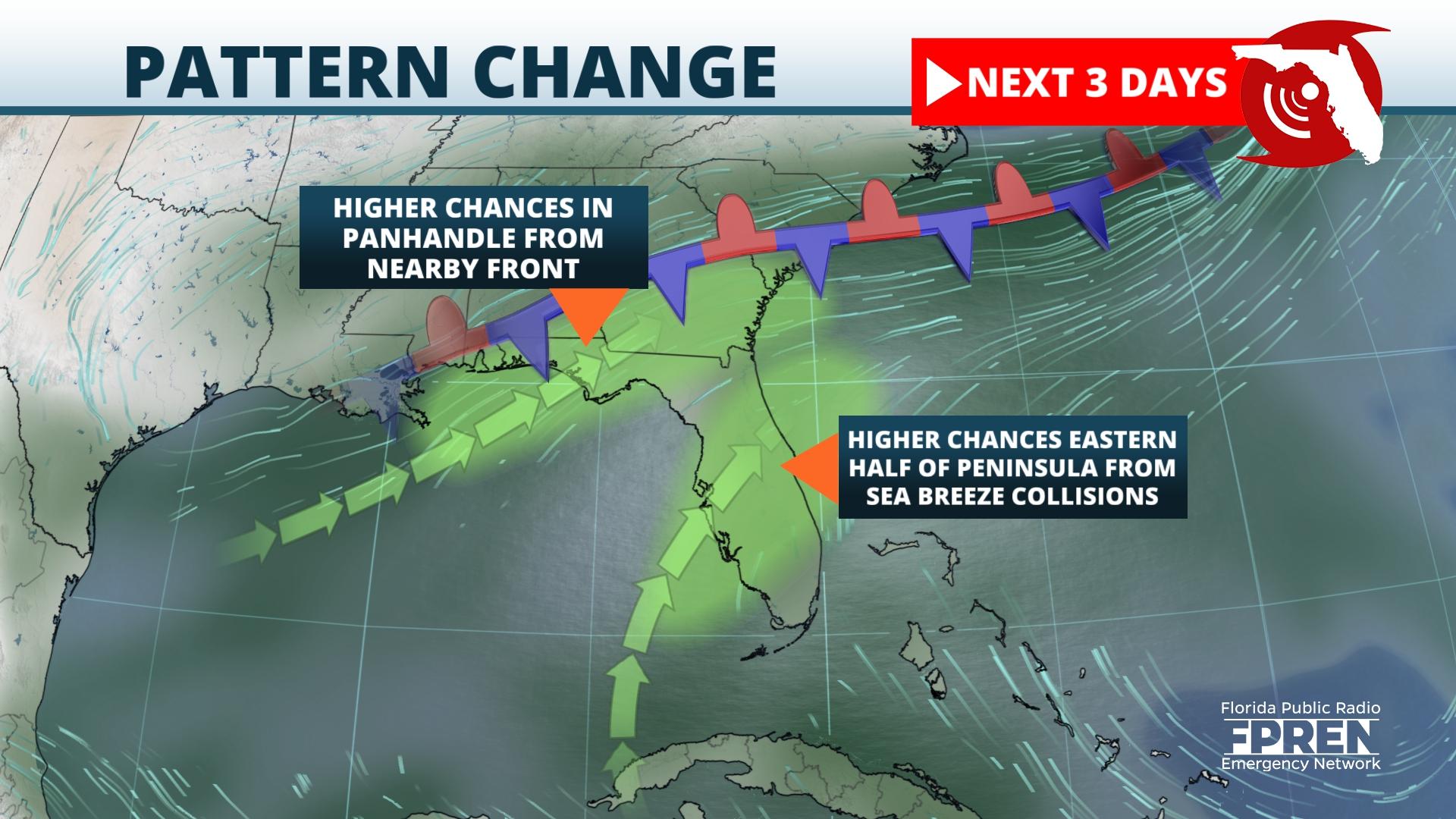
A slow-moving front drifting through the Southeast is forecast to induce a more dominant southwesterly wind, drawing deeper moisture into the atmosphere from the Gulf of Mexico toward the front. The moisture will intersect the lift from the nearby front in the Florida Panhandle and along the I-10 corridor from Tallahassee to Jacksonville, which is where showers and thunderstorms will be most widespread through midweek.
A second area of higher rain chances will develop this week along a progressive Gulf Coast sea breeze that will likely trigger broken lines of cells on its journey inland each afternoon. Where this boundary interacts with a pinned Atlantic Coast sea breeze is where stronger and more numerous storms could develop by the early evening hours, which will likely be near and just west of the the I-95 corridor from Jacksonville to Miami, including the Orlando metro area.
This type of pattern generally leads to drier weather immediately along the Gulf Coast from Florida's Big Bend to Tampa, including areas along the Nature Coast and near or west of I-75 in North and Central Florida. The added cloud cover from the more widespread thunderstorm activity also tends to limit afternoon heating and reduce daytime highs, which is also in the forecast for most Florida cities. The deeper moisture and stalled front is forecast to linger across much of Florida through at least Thursday, before the front weakens and higher pressure builds in Friday or Saturday.


