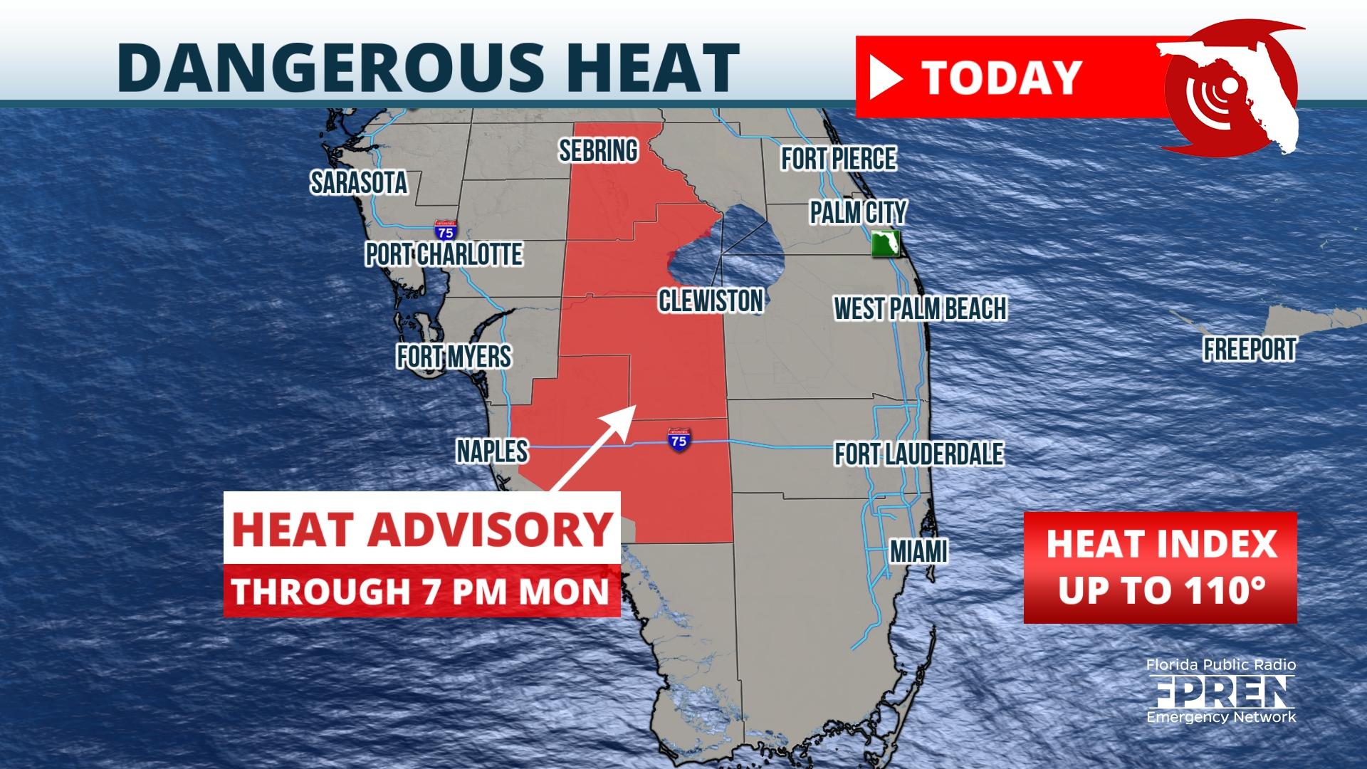
Florida is about to see some relief from the excessive heat that was over a large part of the state this past weekend, but it will come at a price.
Heat Advisories continued for one more day on Monday from Highlands county southward into interior Collier county where the heat index is expected to reach 110 degrees.
Southwest winds through a large chunk of the atmosphere are blowing in off the Gulf over much of the rest of the state ahead of a strong front that is stalling over Georgia. Storms are expected to develop within this moist wind flow along sea breezes, as is often the case. However, boundaries from additional storms developing along and ahead of the front will collide with the sea breeze storms, resulting in widespread storms for much of this week.
Thunderstorms will tend to favor areas along the Gulf coast over the Panhandle and Peninsula during the early morning hours this week. The storms will develop inland and favor the Atlantic side of the peninsula during the afternoon and early evening. Overnight thunderstorms are not as common, but they are more probable from Monday night through Wednesday night thanks to the presence of the front just north of the state. These overnight storms will tend to favor areas north of the Interstate 4 corridor.
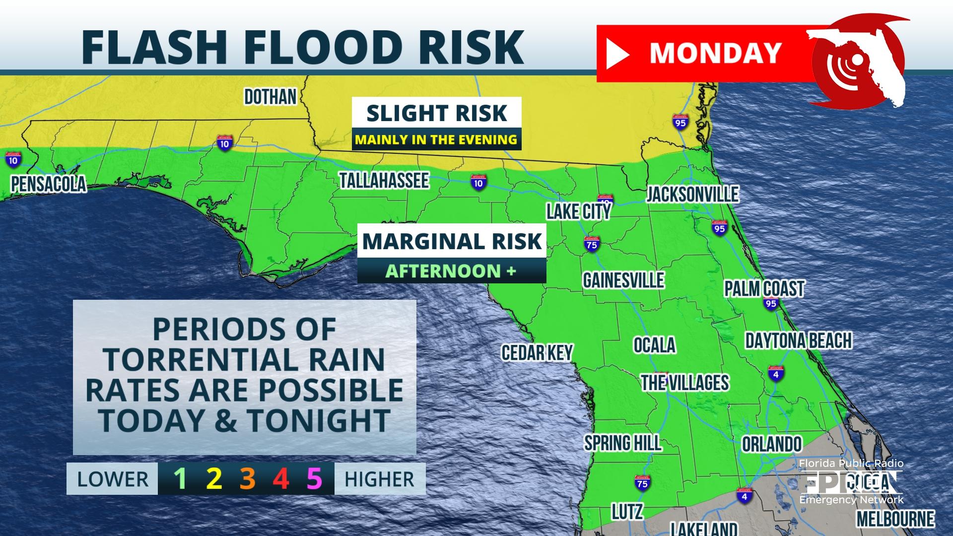
Rainfall amounts are forecast to average between 2 and 5 inches over a large area this week. The greatest amounts are likely over the Panhandle, North Florida, and from the spine of the peninsula to the Atlantic coast. Overall amounts may be a little lower from Sarasota county southward to Fort Myers and Naples compared to other areas of the state because of the southwesterly wind pattern. Higher amounts are possible anywhere in the state where storms are more persistent, with the Nature Coast favored for the locally higher rain totals.
There are signs a subtropical ridge over the Bahamas will build back over the state Friday or Saturday. Should that occur as the global models currently forecast, rain chances will start to transition back to a more typical afternoon and early evening pattern toward the upcoming weekend.


