Anticipated heavy rainfall over the coming days have resulted in Flood Watches for much of the Nature Coast, Big Bend, and stretching as far west as the Panama City area in the Panhandle.
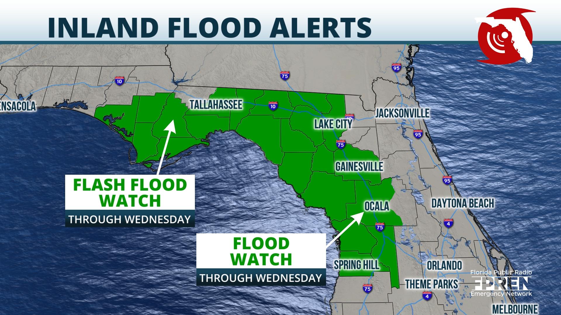
The National Weather Service is forecasting 2 to 4 inches of rain, with amounts up to 6 inches, from Panama City to Tallahassee, including the Forgotten Coast. Greater amounts of 4 to 8 inches are possible farther east and south along the Nature Coast to near Gainesville and to areas just north of the Interstate 4 corridor.
Previous rainfall over the past couple of days is making these areas more prone to flooding, particularly with more rain on the way.
Southwest winds ahead of a slow-moving front over Georgia are directing deep amounts of moisture over the Panhandle, and parts of North and Central Florida. Rounds of showers and thunderstorms are possible at almost any time of the day or night in this type of pattern. Oftentimes, the heaviest rain will occur during the morning hours near the Nature Coast and North-Central Florida and then spread to the Atlantic coast during the afternoon and early evening hours.
A ridge of high pressure over the Atlantic Ocean is gradually forecast to build westward over the Sunshine State this weekend into early next week. As it does so, the storm activity will tend to pushed back into a typical afternoon and evening pattern of showers and thunderstorms from sea breezes.
If the ridge is strong enough, as some models suggest, the number of storms may also decrease later this weekend, which would bring a needed break to the wet pattern for some.


