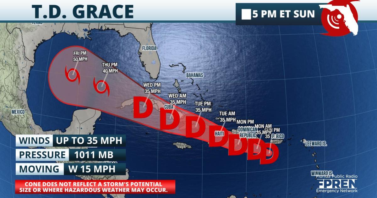
Update as of 5 PM Sunday: Grace weakened to a depression over the eastern Caribbean late Sunday afternoon. It is still on course to come near or pass over Hispaniola on Monday.
The forecast track has shifted southward over the past 24 hours. Grace is forecast to move over or near Hispaniola Monday and Cuba Tuesday and Wednesday. It is also likely to experience wind shear, preventing it from getting stronger. If Grace is able to hold together, it may find a somewhat more favorable environment for strengthening in the Gulf of Mexico Thursday and Friday.
Update as of 5 PM Saturday: A Hurricane Hunter Aircraft investigating Tropical Storm Grace found it to be much more disorganized than what satellite imagery led meteorologists to believe earlier Saturday. The low-level circulation is poorly defined. However, environmental conditions still favor strengthening as Grace moves through the Lesser Antilles Saturday night and near or south of Puerto Rico on Sunday.
The intensity of Grace will depend on whether it moves directly over Hispaniola or Cuba Tuesday and Wednesday. If it spends a lot of time on those islands, it is possible the system will substantially weaken like Fred did. If it can stay south or north of those islands, it may have a better chance at strengthening if the wind shear remains weak enough. That, too, is a question mark and uncertainty in the intensity forecast is very high at this time.
Original Story from 11:30 AM Saturday: Tropical Storm Grace formed early Saturday morning and it is poised to take a track that is similar to Tropical Storm Fred before it.
Tropical Storm Warnings were in effect for many of the Leeward Islands, the U.S. and British Virgin Islands, and Puerto Rico ahead of Grace. Tropical storm force winds are likely to overspread the Leeward Islands late Saturday night, the Virgin Islands on Sunday, and Puerto Rico by Sunday evening.
Grace is moving rapidly toward the west near 22 mph as of the midday Saturday advisory from the National Hurricane Center. The storm is likely to gradually strengthen in an environment of warmer water temperatures and low wind shear through the remainder of the weekend. The forecast track brings the tropical storm over or near Puerto Rico on Sunday night and mountainous Hispaniola Monday afternoon and Monday night. If there is direct land interaction, Grace is likely to weaken. Most of the reliable global models also forecast Grace to interact with an upper-level trough of low pressure and then experience wind shear by the middle of the week. These two factors generally favor a weakening trend.
If Grace manages to miss or spend less time over land, or the wind shear is weaker than currently expected, then it could be somewhere between Cuba and South Florida on Thursday. For this reason, interests in Florida should occasionally monitor the forecasts for possible changes in the coming days.
9(MDA5NDY0MjA5MDEzMzcwMjQ4MTUxZWMwMg004))
