The heat and humidity will be higher than usual Thursday afternoon — even by Florida standards.
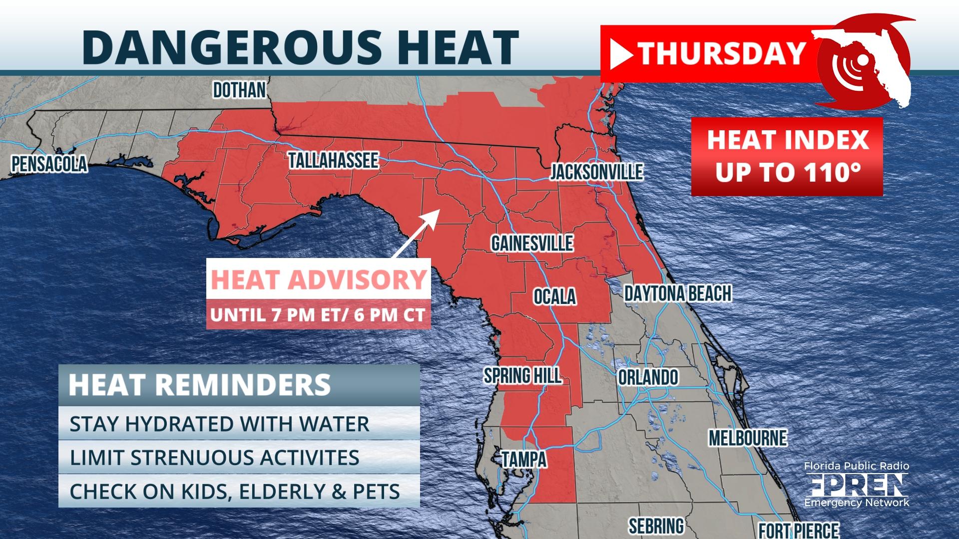
The National Weather Service issued Heat Advisories for a large portion of North and Central Florida, the Florida Big Bend, and eastern Panhandle through early Thursday evening. Heat indices could be as high as 110 degrees within the advisory area.
Actual air temperatures are forecast to top out in the mid 90s. That may be hot enough for a record in Leesburg, which is 96 degrees set in 2007. Two records were set on Wednesday: Tampa hit 97 degrees at the airport, breaking its record of 95 in 1960. Sarasota reached 96 degrees, tying its record from 1990.
Another day of above normal temperatures are forecast on Friday, and many of the same areas could see heat indices reach or exceed 105 degrees. The large heat ridge over the Sunshine State is forecast to move westward along the Gulf coast this weekend. As it does, it will be replaced by an upper-air trough with better chances of thunderstorms starting late in the morning or early in the afternoon hours.
9(MDA5NDY0MjA5MDEzMzcwMjQ4MTUxZWMwMg004))


