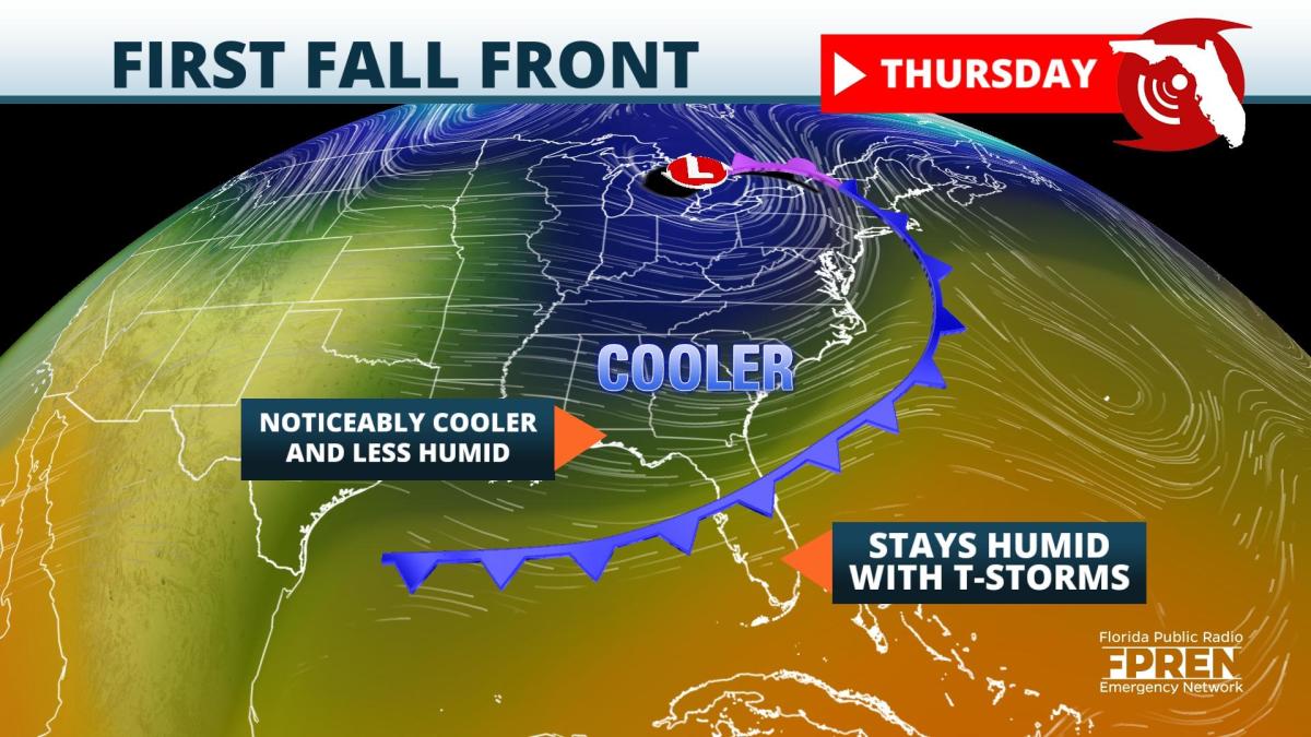
Floridians usually have to wait much longer than the first day of autumn for that "fall feel" in the air. That won't be the case this year for those living north of I-4, as a noticeable cold front surges in.
The front will be approaching the Florida Panhandle Wednesday, sweeping across North Florida Wednesday night, then slowing to a crawl across Central Florida Thursday. The front will likely never make it to South Florida before it dissipates this weekend.
Scattered showers and thunderstorms will mark the arrival of the front Wednesday afternoon and evening as it moves across the northern third of the state. Numerous thunderstorms will also likely develop across central and southern sections of the Sunshine State where deeper moisture resides. This trend will likely continue Thursday and Friday for locations along and south of where the boundary stalls.
Behind the front, temperatures and dew points will fall 5 to 10 degrees on average. The lower dew points will yield lower humidity values. THis will make the air mass noticeably more comfortable, especially during the evening and morning hours. Afternoon highs will fall to the upper 70s and lower 80s across the Panhandle and North Florida Thursday through Saturday, with overnight lows dipping into the 50s and 60s for the first time in several months.
The cooler and drier air across the northern half of Florida will gradually be replaced with an increasingly warmer and humid air mass by early next week, and our eyes will then turn to the tropics. A future development, likely to become Tropical Storm Sam, is expected to move across the Atlantic Ocean next week. Unlike its predecessors Peter and Rose that turned north, long range forecast models suggest this system will be steered in more of a westerly direction and could approach the Leeward Islands or Bahamas in 8 to 10 days. However, it is far too soon to credibly project whether Sam will become a threat to the United States.
9(MDA5NDY0MjA5MDEzMzcwMjQ4MTUxZWMwMg004))


