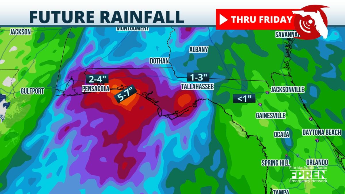
Several more inches of rain over portions of the western Florida Panhandle will extend the threat of flash flooding through Wednesday evening.
The National Weather Service has continued Flash Flood Watches from the Tallahassee area westward to the border with Alabama and southward to the Gulf coast. Bay, Walton, Okaloosa, Santa Rosa, and Escambia counties, south of Interstate 10, have been particularly hard hit with heavy rain since late Sunday. Rain gauge data and estimates from radar indicate that 5 to 10 inches of rain have already fallen, and more is to follow.
 A large and deep trough of low pressure stretches from the lower Ohio Valley into the middle and lower Mississippi Valley. This low is largely "cut off" from the main jet stream, which means it will move slowly this week. Broad southerly winds from the Gulf through a deep layer of the atmosphere will transport moisture northward, resulting in periods of heavy rain and flash flooding.
An additional 3 to 6 inches of rain is forecast across the watch area through Wednesday evening. This new rain on top of what has already fallen will enhance the risk for flash flooding. There are signs the rain will become more intermittent on Thursday into the upcoming weekend as a ridge of high pressure builds along the Gulf coast states into the Florida Panhandle.
9(MDA5NDY0MjA5MDEzMzcwMjQ4MTUxZWMwMg004))


