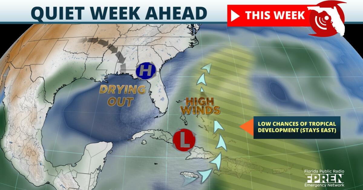
Drier air and higher pressure aloft favor a quiet week of weather across the Sunshine State. And despite three areas of interest being monitored for possible tropical development, strong winds aloft will prevent them from becoming threats over the next five days.
The first disturbance of note was an area of low pressure located just east of North Carolina, referred to by meteorologists as Invest 92L. In their 8 pm Tropical Outlook, the National Hurricane Center said dry air and strong upper-level winds are likely to prevent it from acquiring tropical characteristics as it moves away from the United States this week.
The circulation around 92L, has allowed this drier air aloft to move all the way into Florida. This will effectively reduce or eliminate rain chances across most of the state for several days. The only exception will be spotty and brief showers that form from an onshore east-northeasterly flow along the eastern half of the peninsula each afternoon. Rain chances will be highest where low-level moisture is the greatest, which is projected to be mostly in east-central and southeast Florida. Otherwise, a generally dry and comfortable weather pattern is in the forecast for most of the upcoming work week statewide.
Two other disturbances have been identified as having "low chances" of tropical development, but are likely to also encounter inhibiting conditions. One was located south of Puerto Rico, and the other a few hundred miles east of the Lesser Antilles. While brief tropical development remains possible, their eventual outcome will likely be doomed by the same vast area of strong winds aloft covering much of the Southeast, western Atlantic, and the Caribbean.
The peak of the 2021 Atlantic Hurricane Season has passed, but Florida is still susceptible to landfalling tropical systems this time of year. However, long-range forecast data suggests the deterrent factors that are present now - namely the dry air and high amounts of wind shear - are likely to be around through at least the next 10 days. Nonetheless, tropical storms or hurricanes have and still could impact the United States in late October and through much of November.
9(MDA5NDY0MjA5MDEzMzcwMjQ4MTUxZWMwMg004))


