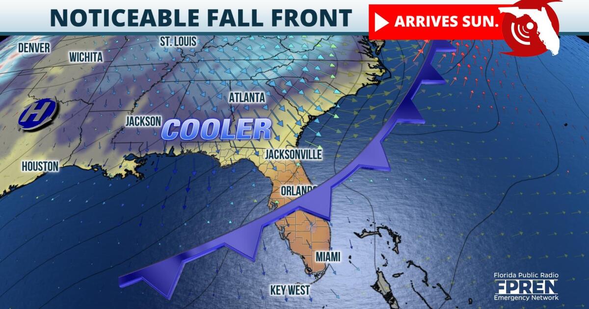
The coolest air yet of the young fall season is expected to arrive Sunday across the Sunshine State. Noticeably lower humidity values are expected as far south as Miami.
The ridge of high pressure that has been responsible for the recent stretch of above-normal warmth across the Southeast will be replaced by an approaching cold front Saturday night. Upper-level winds will steer the front deep into South Florida by late Sunday.
The cooler air will be first felt in the Florida Panhandle Saturday night, where overnight lows will dip into the 50s. The cooler air will then spread south and east into north-central Florida during the day Sunday, where high temperatures will struggle to hit 80º. This will be 10 to 12 degrees cooler than afternoon highs have been for these locations in recent days, and Sunday night low temperatures could dip into the 50s as far south as the I-4 corridor. Temperatures will only cool by a few degrees behind the front in South Florida Monday, but humidity levels will drop enough to make for more pleasant evenings and mornings.
Rainfall will be minimal along the front due to a lack of moisture and its fast forward motion. Nonetheless, scattered showers will mark its arrival across the Florida Panhandle Saturday afternoon, North Florida Saturday night, and during the early part of the day Sunday in central and south Florida.
In the tropics, the Atlantic basin has been relatively quiet and it will most likely stay that way for the next several days. There is an area of low pressure the National Hurricane Center is watching northeast of the Turks and Caicos Islands. However, it only has a ten percent chance of development and is moving farther away from the land to the east-northeast.
Meteorologist Vanessa Abuchaibe contributed to this story.
9(MDA5NDY0MjA5MDEzMzcwMjQ4MTUxZWMwMg004))


