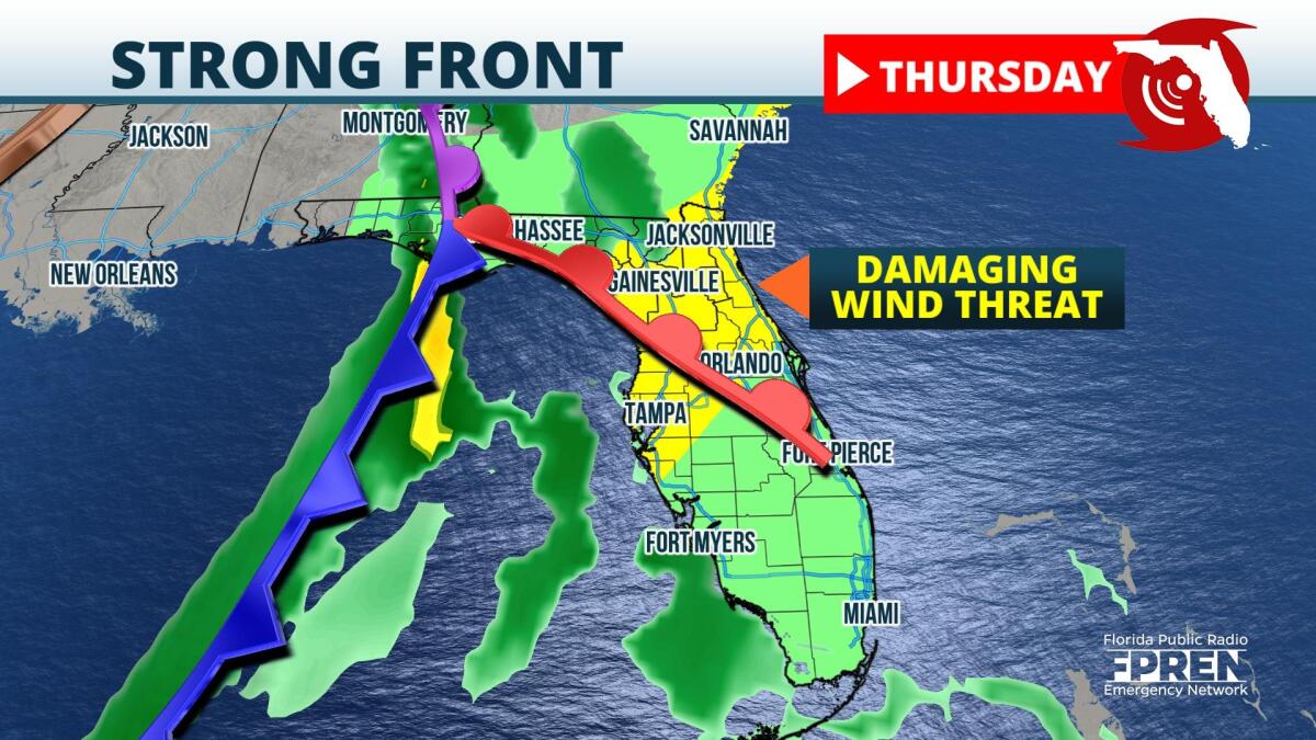
Wind damage and isolated tornadoes are possible Wednesday night and Thursday across Florida ahead of a strong fall cold front.
A powerful storm system is expected to move across the Deep South Wednesday. The warm front associated with this area of this low pressure will approach the Florida Panhandle Wednesday night, where scattered strong thunderstorms are expected. Forecast data suggests enough rotation could be in the atmosphere to produce a brief tornado. Individual cells are then forecast to gradually merge into a line of cells overnight Wednesday, capable of producing wind damage along its journey to the Emerald Coast and Big Bend regions before daybreak Thursday.
Clusters of thunderstorms are likely to approach the Nature Coast and Sun Coast Thursday morning. Damaging winds are the greatest hazard, but embedded tornadoes and waterspouts cannot be ruled out along the line, especially where smaller-scale coastal winds could enhance low-level rotation. Clusters of showers and thunderstorms are then forecast to approach Central Florida Thursday afternoon, moving into cities such as Orlando and Melbourne.
Strong thunderstorms are also expected across South Florida Thursday afternoon and evening, where a bit more daytime heating and instability could be in place for them to tap into. Similar to the rest of the state earlier in the day, damaging winds remain the biggest hazard with any of the stronger cells, but heavy rainfall could also lead to localized flooding along the Gold Coast through Thursday night.
The front responsible for the unsettled weather Thursday should push offshore by Friday afternoon, allowing breezy northwesterly winds and much cooler weather to settle in across Florida by the end of the week.
9(MDA5NDY0MjA5MDEzMzcwMjQ4MTUxZWMwMg004))


