Update at 12:30 am EDT: New Tornado Watch has been issued for the Big Bend region of the Florida Panhandle.
Update at 8:30 pm EDT: A Tornado Watch has been issued for the western side of the Florida Panhandle.
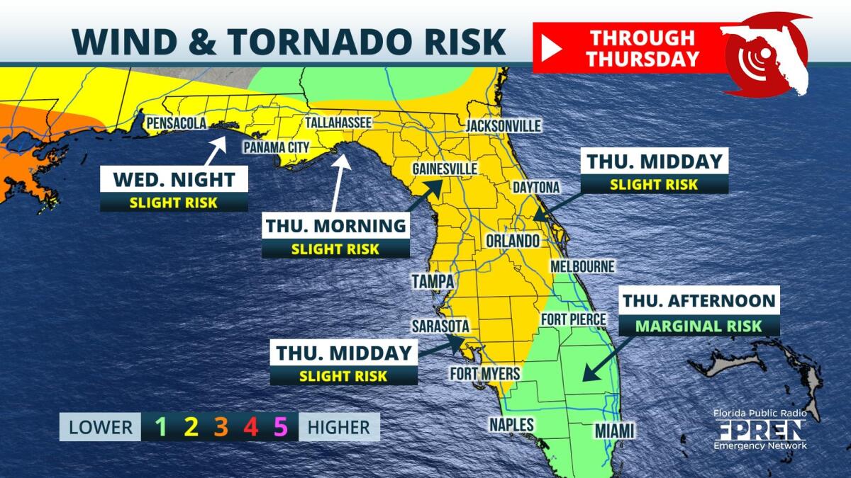
Original story posted early Wednesday evening: Damaging winds and a few tornadoes are possible Wednesday night and Thursday across Florida, as a powerful storm system pushes through the Sunshine State.
Here's the latest timeline of the arrival of storms by region:
A warm front associated with an area of this low pressure will approach the Florida Panhandle during the overnight hours, where scattered strong thunderstorms are expected. Data suggests that there could be enough wind shear, instability and lift in the atmosphere to produce a brief spin-up tornado in small individual cells. The storm cells should merge into a squall line, capable of producing damaging winds along the Emerald Coast and Big Bend regions before sunrise Thursday morning.
Clusters of thunderstorms are likely to approach the Nature Coast and Sun Coast Thursday morning ahead of the powerful front. Damaging winds should remain the greatest hazard, but brief isolated tornadoes and waterspouts can't be ruled out along the line. Clusters of showers and thunderstorms are then forecast to approach Central Florida Thursday afternoon, moving into cities such as Orlando and Melbourne.
Strong thunderstorms are also expected across South Florida Thursday afternoon and evening, where a bit more daytime heating and instability could be in place for them to tap into. Damaging winds will remain the biggest hazard with any of the stronger cells, but heavy rainfall could also lead to localized flooding along the Gold Coast through Thursday night.
The cold front responsible for the unsettled weather Thursday should be out of here on Friday, allowing for more northwesterly winds and much cooler, nicer weather to settle in across Florida for the weekend.
Meteorologist Vanessa Alonso contributed to this report.
9(MDA5NDY0MjA5MDEzMzcwMjQ4MTUxZWMwMg004))


