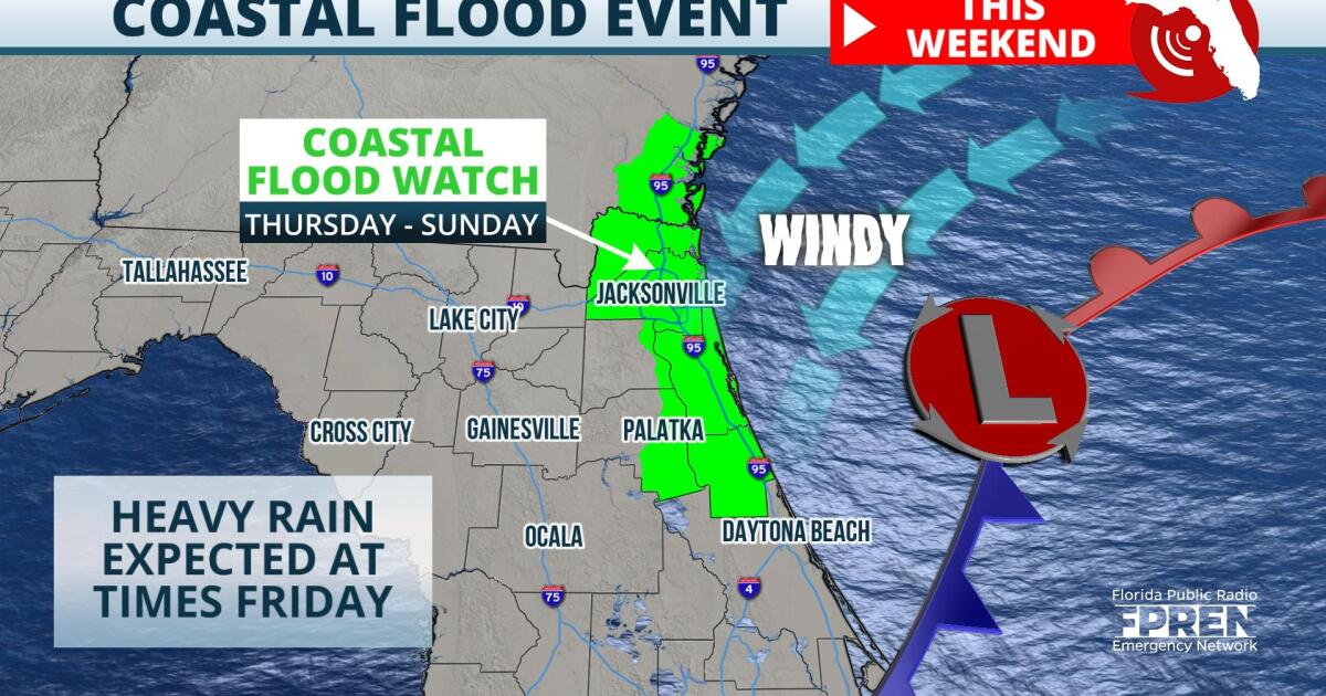
Significant tidal flooding is expected along the St. Johns River and St. Mary's River basins beginning Thursday. Moderate to potentially major coastal flooding is also expected along the First Coast beaches and inland tributaries by Friday and Saturday.
Residents near these bodies of water are encouraged to secure any river or ocean-front property prone to wave action or tidal flooding.
Forecasters at the National Weather Service say that a storm system will develop of the Atlantic Coast over the next few days, creating gusty winds and increasing tide levels. As a result, a Coastal Flood Watch has been issued for portions of Nassau, Duval, St. Johns, Clay, Flagler, and Putnam counties from Thursday morning until Sunday morning.
An area of low pressure off the North Florida coast will deepen through Saturday, resulting in strong north to northeasterly winds. Models show sustained winds over the Atlantic of up to 35 mph through Saturday evening, which will act to pile up water near the immediate coastline. The likelihood for significant flooding this weekend isn't just due to a strong onshore flow, but also the ebb and flow of the tidal cycle.
Astronomical tides peak November 4th through the 8th, coinciding with the strengthening low pressure off the North Florida coast. High tides will reach over seven-feet in several locations along the First Coast Friday into Saturday, according to the National Oceanic and Atmospheric Administration's Tide Prediction tool.
Travelers are urged to pay close attention to road conditions during this time, as flooding may result in road closures. Where tidal flooding covers roadways, drivers are asked to seek an alternate route and not drive around barricades or through water of an unknown depth. Property in low-lying areas, including homes and some businesses, may be inundated with flood waters through Sunday morning, and critical infrastructure may also be affected.
Higher pressure is forecast to settle into the region by Sunday afternoon, allowing the flood risk to subside as onshore winds ease along the First Coast.
9(MDA5NDY0MjA5MDEzMzcwMjQ4MTUxZWMwMg004))


