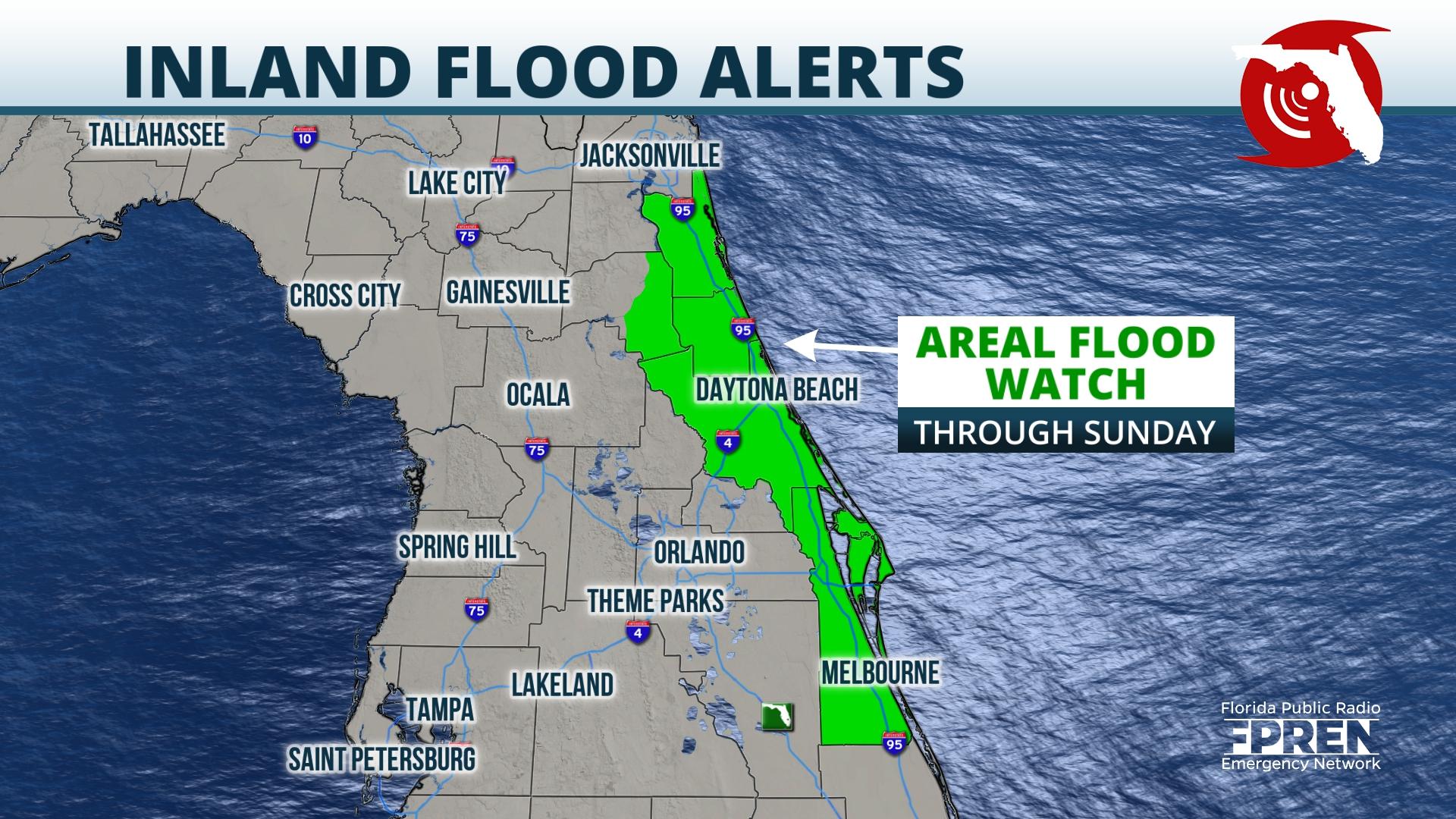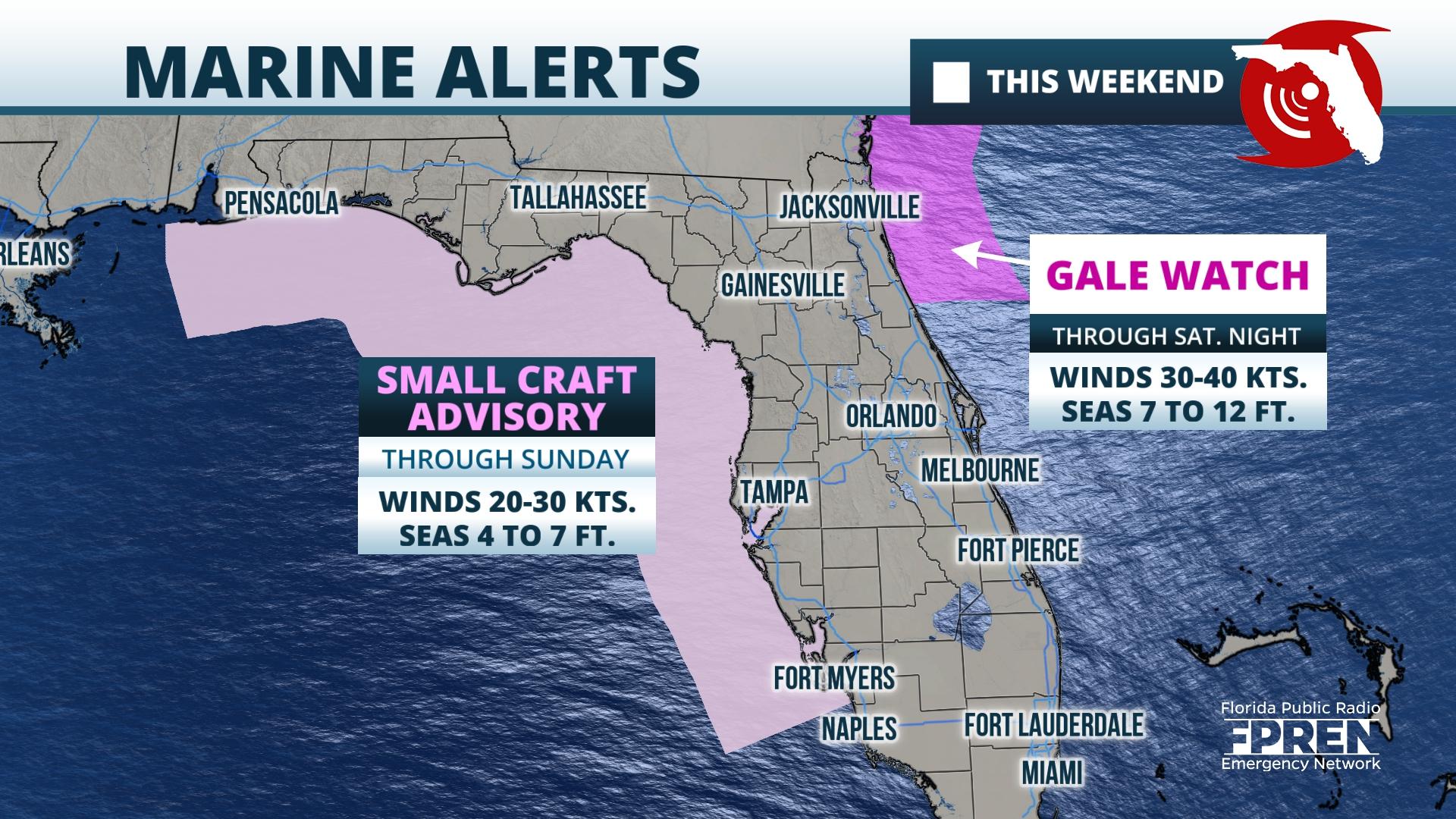
A storm system moving in from the Gulf of Mexico will soak most of Florida to start the weekend, and in a few spots could produce significant flooding and strong thunderstorms before it exits the state Saturday.
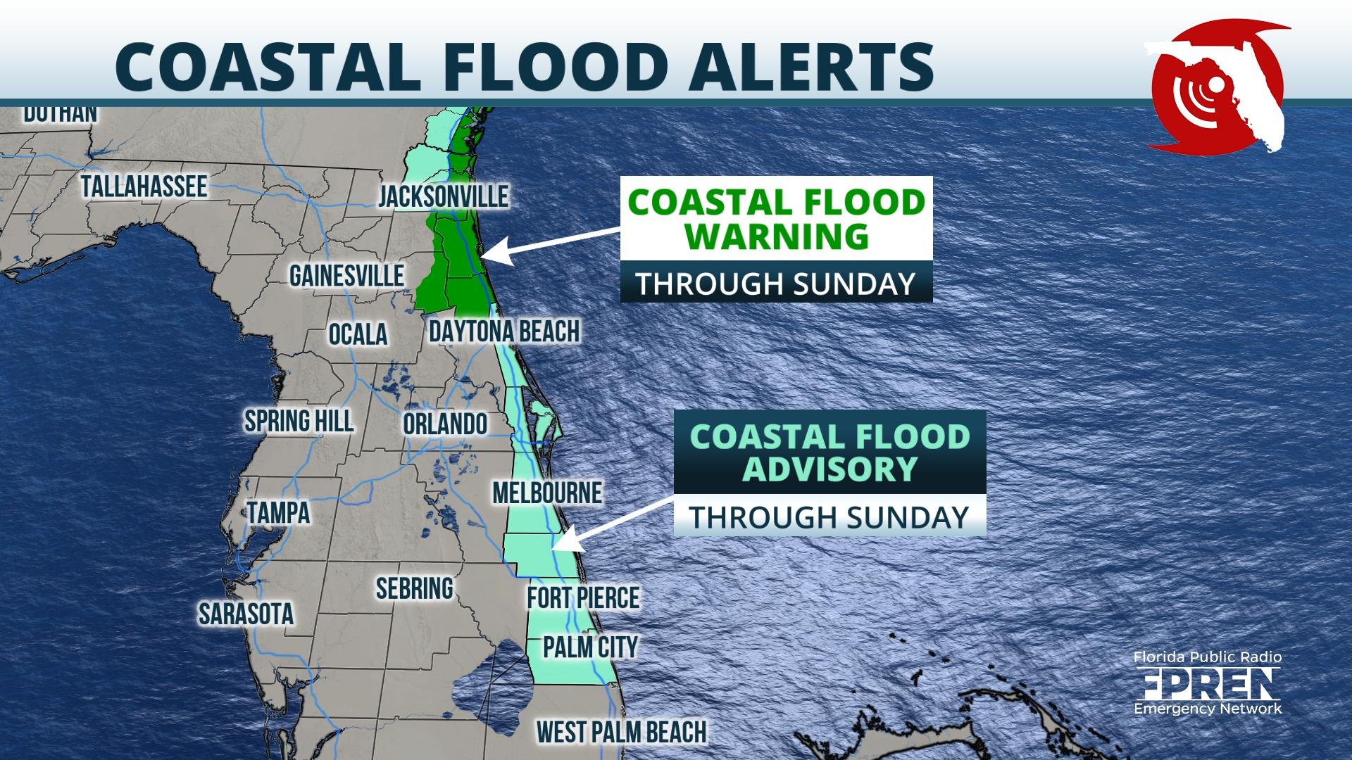
A steady rain is forecast to overspread much of the Florida Peninsula Friday, becoming heavy enough to produce potential flooding Friday night across portions of northeast Florida. The National Weather Service (NWS) says "significant" coastal flooding is also expected along the First Coast as a persistent onshore wind develops ahead of and behind the storm system. And thunderstorms capable of producing minor wind damage are also possible across much of central and south Florida Friday night ahead of an associated cold front.
Residents or visitors with interests near waterfront property along the St. Johns and St. Mary's river basins, in addition to those near the First Coast and Space Coast beaches, are encouraged to secure loose items and prepare for flooding. According to a statement issued by the NWS for these areas, impacts from the flooding could include the closure of numerous roads, inundation of low-lying homes and businesses, and some shoreline erosion.


Various advisories and watches have been issued for this event by the National Weather Service through the weekend for potential flooding and hazardous seas, which are summarized below.

The heaviest rainfall from this storm system will likely occur in two areas. The first will be associated with the persistent onshore flow from the Atlantic interacting with the area of low pressure moving in from the Gulf of Mexico Friday and Friday night, which is likely to lead to multiple rounds of heavy rain from Melbourne to Jacksonville where 4 to 6 inches may accumulate through Saturday. A secondary maximum of heavy rain is also possible on the backside of the departing storm system Friday night and Saturday across inland areas of North Florida, in particular near or west of I-75 and along the Nature Coast where 2 to 4 inches may fall. Elsewhere across the Florida Peninsula (mostly in central and southern sections), widespread rainfall amounts of 1 to 3 inches are expected.
Strong thunderstorms will be possible on the warmer side of the storm system where a cold front approaches a more humid and unstable air mass. This will most likely be confined to areas south of the I-4 corridor Friday afternoon and evening, where some cells might be capable of producing minor wind damage or even a brief tornado. The risk of these hazards is a bit uncertain at the time, but it will be maximized near the coastlines where storms have greater moisture and energy to tap into.
The storm system likely to wash out many outdoor plans Friday and Saturday across the state will depart the region quickly Sunday. The rain and thunderstorm activity will end Saturday night, but the choppy seas and coastal flooding are likely continue to some degree through Monday as the winds only gradually subside. The coolest air of the fall season will follow the storm Sunday and Sunday night, but skies will clear and temperatures will moderate some by early next week.
9(MDA5NDY0MjA5MDEzMzcwMjQ4MTUxZWMwMg004))
