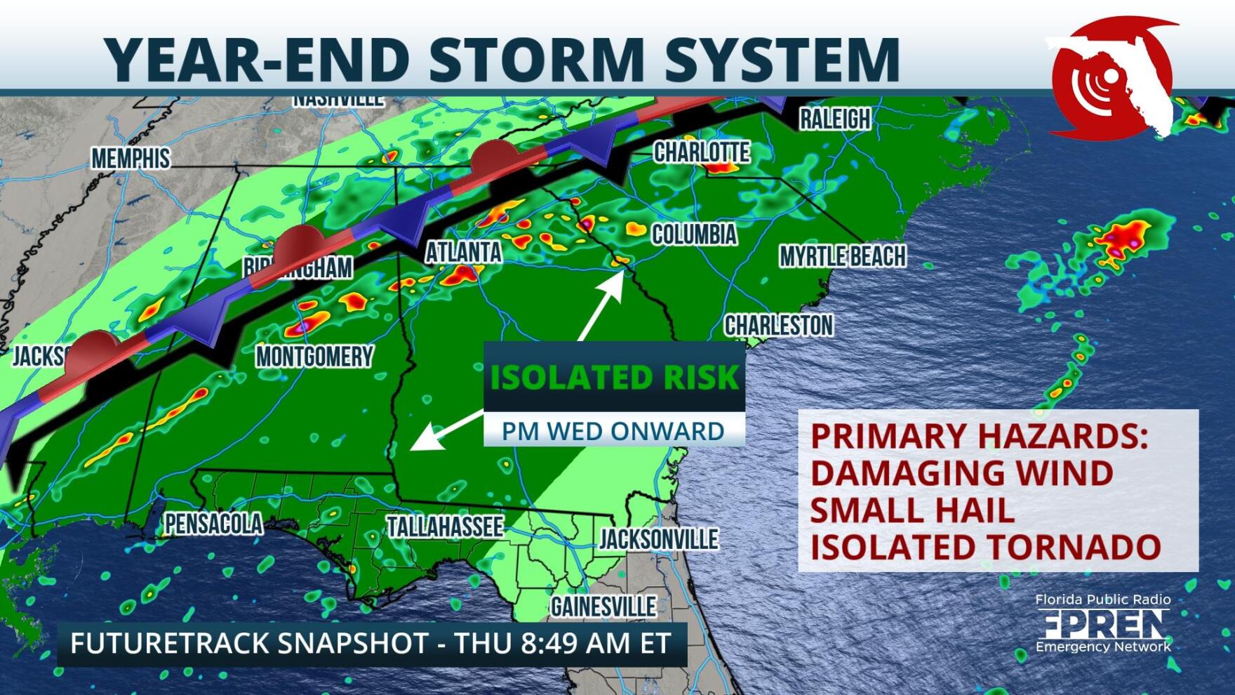
 ,Strong storms and damaging winds are possible over the Panhandle through Thursday, as a cold front traverses the Lower Mississippi Valley.
Low pressure developed on the eastern side of the Rockies Tuesday and moved into the Great Lakes region. By early Wednesday, a powerful cold front extended from this low pressure center into the Deep South. The boundary is expected to continue on a slow east-southeastward track through the end of the week and winds it's vicinity are expected to increase the chance for severe thunderstorms over the Southeastern United States.
A few strong storms had already occurred over the Panhandle by Wednesday evening, fueled by the moisture rich winds from the warm Gulf of Mexico. Another batch of potentially severe thunderstorms is possible over the Panhandle, and parts of the Big Bend on Thursday, as southwesterly winds continue to draw a warm and relatively humid airmass over the region.
The main threat, as of writing, will likely be damaging wind gusts. However, models indicate that moderate wind shear could be available to provide an element of "spin" to the thunderstorms. These conditions could support storms capable of producing small hail, or even an isolated tornado.
Storms should be on a weakening trend as they approach Tallahassee through Thursday morning, but a few damaging wind gusts remain possible. The start of a New Year could bring yet another powerful cold front accompanied by strong thunderstorms to the Panhandle. The weather pattern turns much cooler and calmed into the first week of 2022.
9(MDA5NDY0MjA5MDEzMzcwMjQ4MTUxZWMwMg004))
