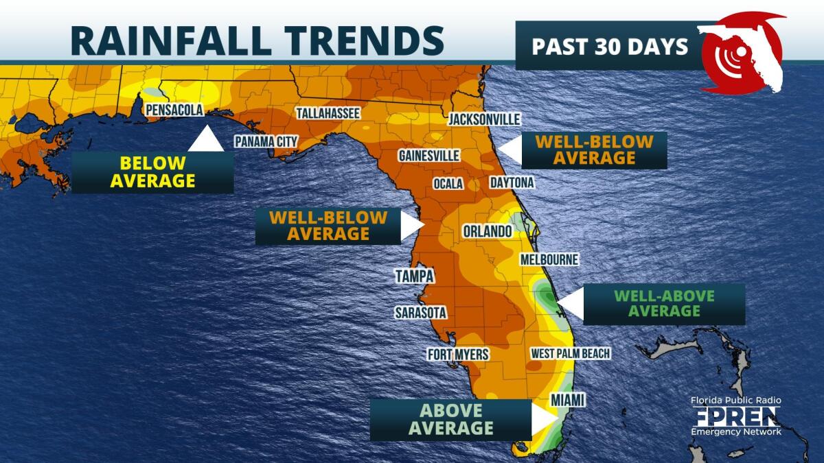
A warm and dry winter is expected across the Sunshine State, according to the latest outlook from the National Weather Service Climate Prediction Center. These forecasted conditions could lead to the gradual onset of drought, and an active 2022 Florida wildfire season.
The abnormally dry conditions are a consistent sign of La Niña, which is a periodic cooling of the Pacific waters off the coast of South America. During the winter months when La Niña is present, the Southeast typically experiences warm and dry weather. Some of the most active wildfire seasons in Florida have occurred during periods of La Niña, particularly during the 1970s and 1980s. The full extent of what the wildfire season could bring is yet to be realized, as the season does not typically get underway until February.
Widespread rain has been lacking since the start of December, with some spots in the Panhandle running nearly 3-inches below average. The rest of the Sunshine State is also behind in rainfall, especially in Tampa and Fort Myers, where rainfall is as much as 2-inches below average. South Florida is the only location where rainfall is running slightly above normal, according to the National Oceanic and Atmospheric Administration (NOAA) Regional Climate Center.
 ,Global weather models suggest a wetter pattern gets underway starting next week, with rain chances looking highest early in the week. The chance for rain arrives first across North Florida Sunday, but rain chances slowly push across Central Florida Monday along a cold front. A non-tropical low is forecast to develop Monday night before moving over the state Tuesday. Rounds of heavy rain and even thunderstorms could bring portions of the state several inches of rainfall, before cooler and drier air settles into the region in time for Christmas.
9(MDA5NDY0MjA5MDEzMzcwMjQ4MTUxZWMwMg004))
