 ,Above average temperatures are expected to blanket the Sunshine State over the next few days, before another front– and the chance for thunderstorms– arrives on Friday.
Last weekend, a strong trough of low pressure contributed to showers, gray skies, and cooler temperatures over part of the state. That feature has been slow to depart into the Atlantic ocean, but as of Tuesday afternoon it had done so and strong high pressure was building over the Northeast in it’s wake. Easterly winds around the high had allowed skies across Florida to become sunny, and winds, especially along the coast, to become gusty.
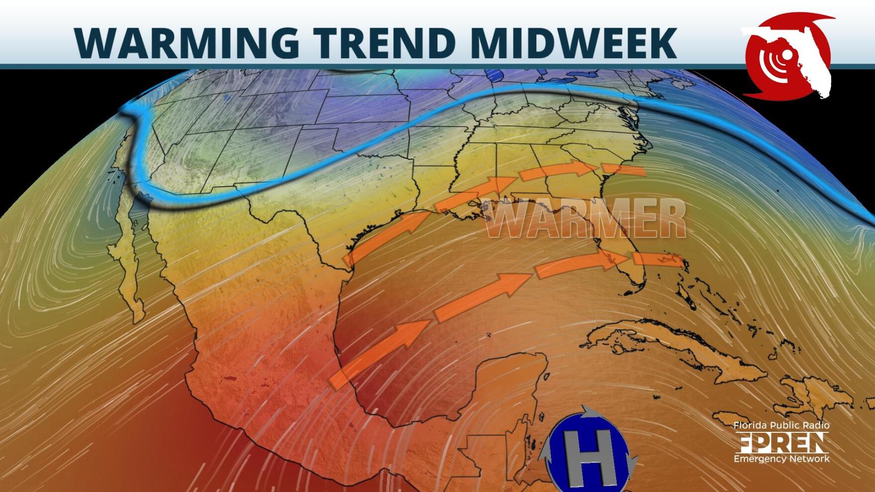
Farther west a stronger ridge of high pressure, indicative of warmer than average temperatures, was building over the Southern Plains. Over the next few days, that ridge is forecasted to push eastward into the Southeast, bumping up temperatures and nudging humidity levels. By Wednesday afternoon highs from the Panhandle to South Florida should reach the mid to upper 70s. On Thursday, parts of North and Central Florida could reach the mid 80s, and a few record high temperatures could be met or exceeded, especially in the Tampa metro area.
Mid and upper level ridging, and the well above average warmth, will be chased out of the Southeast late Thursday by a developing trough of low pressure. The cold front trailing from the low is expected to arrive first to the Panhandle on Thursday evening and a few strong thunderstorms are possible over westernmost counties of the Panhandle Thursday night. Parameters will be most supportive of damaging wind gusts, however an isolated tornado cannot be ruled out of the forecast.
The front should arrive to North Florida sometime Friday morning and then track through the remainder of the peninsula Friday afternoon into the overnight. Daytime heating over South Florida could support the potential for isolated strong thunderstorms Friday night when the front arrives there.
A brief drop in temperatures is expected over the Panhandle and North Florida on Saturday, with highs in the 60s. However, winds will quickly turn from northerly to easterly by Sunday, and temperatures across the state should climb back into the 70s.
9(MDA5NDY0MjA5MDEzMzcwMjQ4MTUxZWMwMg004))


